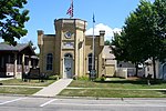
Litchfield Wetland Management District
Landforms of Kandiyohi County, MinnesotaLandforms of McLeod County, MinnesotaLandforms of Meeker County, MinnesotaLandforms of Renville County, MinnesotaLandforms of Stearns County, Minnesota ... and 13 more
Landforms of Todd County, MinnesotaLandforms of Wright County, MinnesotaMidwestern United States protected area stubsMinnesota geography stubsNational Wildlife Refuges in MinnesotaProtected areas of Kandiyohi County, MinnesotaProtected areas of McLeod County, MinnesotaProtected areas of Meeker County, MinnesotaProtected areas of Renville County, MinnesotaProtected areas of Stearns County, MinnesotaProtected areas of Todd County, MinnesotaProtected areas of Wright County, MinnesotaWetlands of Minnesota
Litchfield Wetland Management District is located on the eastern edge of the Prairie Pothole Region in central Minnesota. More than 33,000 acres (130 km2) of United States Fish and Wildlife Service-owned land and 8,000 acres (32 km2) of wetland easements provide marsh, prairie, transition, and woodland habitats. District lands are located on over 150 waterfowl production areas scattered throughout seven counties. These areas vary greatly in size and vegetation and provide habitat for numerous plant and animal species.
Excerpt from the Wikipedia article Litchfield Wetland Management District (License: CC BY-SA 3.0, Authors).Litchfield Wetland Management District
Litchfield Wetland Management DIstrict Office Public Driveway,
Geographical coordinates (GPS) Address Nearby Places Show on map
Geographical coordinates (GPS)
| Latitude | Longitude |
|---|---|
| N 45.070277777778 ° | E -94.531666666667 ° |
Address
Litchfield Wetland Management DIstrict Office Public Driveway
55355
Minnesota, United States
Open on Google Maps


