place

San Diego National Wildlife Refuge

IUCN Category IVLandforms of San Diego County, CaliforniaNational Wildlife Refuges in CaliforniaProtected areas of San Diego County, CaliforniaUse mdy dates from December 2023
Wetlands of California
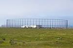
Coastal sage scrub and riparian habitat at San Diego National Wildlife Refuge (6033289259)

San Diego National Wildlife Refuge is a National Wildlife Refuge in California. It is part of the San Diego National Wildlife Refuge Complex. A variety of habitats from coastal sage scrub and chaparral to oak woodland and freshwater marsh describe this inland refuge in San Diego's backcountry.The Living Coast Discovery Center is located in the Sweetwater Marsh Unit adjacent to the administrative headquarters for the US Fish & Wildlife Service. The Center features exhibits of marine life, birds and plants found the San Diego Bay, and partners with the Refuge to offer environmental education programs. There are 1.5 miles of trails with access to the Bay. The Otay-Sweetwater Unit of the San Diego National Wildlife Refuge is part of the National Wildlife Refuge System's contribution to the Multiple Species Conservation Plan, a program designed to conserve enough open space and habitat for species survival while enabling orderly development to occur where necessary. It is closed to the public. San Diego National Wildlife Refuge's abundance of coastal sage and chaparral are an important addition to other inland preserves established to conserve and restore fast diminishing habitat. This inland refuge is home to such endangered birds as least Bell's vireo, California gnatcatcher, a rare butterfly, the Quino checkerspot and to the San Diego horned lizard. Biological surveys for other species are ongoing as new land is acquired. The approved refuge boundary for the San Diego Refuge is 44,000 acres (180 km2), and 8,000 acres (32 km2) for the Vernal Pools Unit.

Excerpt from the Wikipedia article San Diego National Wildlife Refuge (License: CC BY-SA 3.0, Authors, Images).

San Diego National Wildlife Refuge
San Diego Egger Highlands

Geographical coordinates (GPS) Address Nearby Places
placeShow on map

Wikipedia: San Diego National Wildlife RefugeContinue reading on Wikipedia

Geographical coordinates (GPS)

Latitude Longitude
N 32.6025 ° E -117.11472222222 °
placeShow on map

Address

Egger Highlands


San Diego, Egger Highlands
California, United States
mapOpen on Google Maps

Coastal sage scrub and riparian habitat at San Diego National Wildlife Refuge (6033289259)
Share experience

Nearby Places

Rancho Melijo
Rancho Melijo

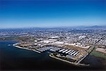
Rancho Melijo, or Milijo, named after a local Kumeyaay village. It was later called Rancho La Punta for the location of the Arguello family ranch house, on a point of hills overlooking the south end of San Diego Bay, north of the Otay River and east of where the river entered the south bend of the bay. It was a Mexican land grant rancho, granted by Governor José Figueroa in 1833 to Santiago E. Argüello.The rancho covered a square league of land extending 1 league north of the San Antonio Hills and 1 league east of the Pacific Ocean from the mouth of the Tijuana River, including its estuary and the plain east up the lower Tijuan Valley, amounting to 4,439 acres of land. The southern part of the land was adjacent to his fathers Rancho Ti Juan and Rancho San Antonio Abad It extended from the foot of the range of hills that the 1856 county map calls the San Antonio Hills just above the modern border of Mexico, to as far north as to include the south end of the San Diego Bay where the Otay River entered the bay and the southern part of the hills on the north side of the Otay River.With the cession of California to the United States following the Mexican-American War, the 1848 Treaty of Guadalupe Hidalgo provided that the land grants would be honored. As required by the Land Act of 1851, a claim for Rancho Melijo was filed with the Public Land Commission in 1852. The claim (91 SD) with the California Land Commission was rejected and failed in appeals to higher courts. The Argüello family retained some of the land, homesteading it in the vicinity of the ranch house north of the Otay River and by the bay.The Rancho Melijo included all of modern Imperial Beach, part of southwestern Chula Vista and the Tijuana River Valley, Otay Mesa West, Nestor and Palm City, neighborhoods of southern San Diego. The ranch house fell into ruin in the 20th century and was razed to make way for the I-5 freeway.