Canusa Street
Canada–United States border crossingsDerby, VermontRoads in EstrieRoads in VermontStanstead, Quebec ... and 2 more
Transportation in Orleans County, VermontUse Canadian English from January 2023

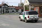
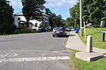
Canusa Street (French: rue Canusa) is a road part of Quebec Route 247. The road primarily runs east-west, connecting Rue Principale to the west and Rue Railroad to the east. A particular 0.38 mi (0.61 km) long stretch of Canusa Street runs along the 45th parallel north, which defines the Canada–United States border. On this stretch of road, the middle yellow line defines the international border and separates Beebe Plain, Vermont, in the United States, from the Beebe Plain area of Stanstead, Quebec, in Canada. This characteristic contributes to the road's name and unique living dynamics for its residents.
Excerpt from the Wikipedia article Canusa Street (License: CC BY-SA 3.0, Authors, Images).Canusa Street
Canusa Avenue,
Geographical coordinates (GPS) Address Nearby Places Show on map
Geographical coordinates (GPS)
| Latitude | Longitude |
|---|---|
| N 45.005835 ° | E -72.138456666667 ° |
Address
Canusa Avenue 166
05823
Quebec, United States
Open on Google Maps


