place

St Pancras Old Church

Anglo-Catholic church buildings in the London Borough of CamdenAnglo-Catholic churches in England receiving AEOChurch of England church buildings in the London Borough of CamdenDiocese of LondonGrade II* listed churches in London
Harv and Sfn no-target errorsSt Pancras, LondonUse British English from February 2015
St Pancras Old Church geograph.org.uk 757784

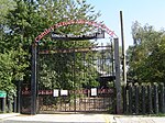
St Pancras Old Church is a Church of England parish church in Somers Town, Central London. It is dedicated to the Roman martyr Saint Pancras, and is believed by many to be one of the oldest sites of Christian worship in England. The church is situated on Pancras Road in the London Borough of Camden, with the surrounding area and its international railway station taking its name. St Pancras Old Church, which was largely rebuilt in the Victorian era, should not be confused with St Pancras New Church (1819–1822) about 860 metres (940 yd) away, on Euston Road.

Excerpt from the Wikipedia article St Pancras Old Church (License: CC BY-SA 3.0, Authors, Images).

St Pancras Old Church
Pancras Road, London Somers Town

Geographical coordinates (GPS) Address Website External links Nearby Places
placeShow on map

Wikipedia: St Pancras Old ChurchContinue reading on Wikipedia

Geographical coordinates (GPS)

Latitude Longitude
N 51.534897222222 ° E -0.13018888888889 °
placeShow on map

Address

St Pancras Old Church

Pancras Road
NW1 1UL London, Somers Town
England, United Kingdom
mapOpen on Google Maps

Website
stpancrasoldchurch.posp.co.uk

linkVisit website

linkWikiData (Q3495349)
linkOpenStreetMap (26638075)

St Pancras Old Church geograph.org.uk 757784
Share experience

Nearby Places

Burdett-Coutts Memorial Sundial

The Burdett Coutts Memorial Sundial is a structure built in the churchyard of Old St Pancras, London, in 1877–79, at the behest of Baroness Burdett-Coutts. The former churchyard included the burial ground for St Giles-in-the-Fields, where many Catholics and French émigrés were buried. The graveyard closed to burials in 1850, but some graves were disturbed by a cutting of the Midland Railway in 1865 as part of the works to construct its terminus at St Pancras railway station. The churchyard was acquired by the parish authorities in 1875 and reopened as a public park in June 1877. The high Victorian Gothic memorial was built from 1877 and unveiled in 1879. The obelisk acts as a memorial to people buried near the church whose graves were disturbed; the names of over 70 of them are listed on the memorial, including the Chevalier d'Éon, Sir John Soane, John Flaxman, Sir John Gurney, and James Leoni. The monument was designed by George Highton of Brixton. It was manufactured by H Daniel and Co, a firm of masons from Highgate, and includes relief carvings by Signor Facigna. It comprises a tall square tower in a decorated Gothic style, topped by a tall Portland limestone pinnacle bearing a sundial, supported by columns of pink Shap granite and grey Cornish granite to either side of four inscribed marble plaques, each topped by a trefoil Gothic arch around a relief sculpture (busts of two saints, St Giles and St Pancras, and of two allegorical figures depicting a youthful Morning with a cockerel and a more aged Night with a star and a crescent moon). The inscriptions on four marble panels include the Beatitudes from the Gospel of St Matthew, chapter 5, verses 3 to 9, and a religious poem. The tower stands on a square plinth of Portland stone, which rests on an octagonal base of three steps made from red Mansfield sandstone. The steps are decorated with mosaic panels, mostly stylised flowers. The structure is surrounded by iron railings which create a square enclosure, with a Portland stone animal statue at each of the four corners, two lions and two dogs. The dogs may be modelled on Greyfriars Bobby, or possibly an animal owned by Burdett-Coutts herself. The railings also bear a plaque to Johann Christian Bach, buried in a pauper's grave nearby. The monument became a Grade II listed building in February 1993, upgraded to Grade II* in September 2016. The garden is itself Grade II listed, and includes the tomb of Sir John Soane. St Pancras Old Church is also Grade II* listed.

St Pancras Waterpoint

St Pancras Waterpoint is a Grade II listed building. water tower originally used to refill steam locomotives at St Pancras station with water. The Victorian Gothic brick structure, designed by the office of Sir George Gilbert Scott, who was also responsible for the Midland Grand Hotel at Pancras station, around 1868. The design included a chimney which was simply a design element and not functional. The building is approximately 9m by 6m and is three stories high with the top containing a cast iron tank capable of holding 68 cubic metres of water. The Waterpoint was originally located further south than its present location, and approximately 100° anti-clockwise from its current orientation. With the enlargement of St Pancras to accommodate International Eurostar services the WaterPoint needed to be moved to make space. In November 2001, following 3 years of planning, it was relocated a few hundred metres from its original location to its present locations. The original intention was to deconstruct the building then rebuild it, however a survey identified that because of the mortar used dismantling and rebuilding the Waterpoint would have resulted in significant damage to the fabric of the building. In addition the lower third of the building had been sufficient damaged that it was not suitable to be transported. The result was that the building was separated into three sections and the top two sections transported to a reconstructed base, the entire project cost £915,190. The building and its site are owned by the London Historic Buildings Trust and are leased to the Canal & River Trust and used by the St Pancras Cruising Club who organises a number of open days during the summer when visitors can visit the water tower.

Camley Street
Camley Street

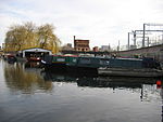
Camley Street is a street in the London Borough of Camden in London, England. It lies in St Pancras and King's Cross: stretching over a kilometre from St Pancras railway station in the south, over the Regent's Canal, and to Agar Grove in the north. Camley Street is the location of Camley Street Natural Park, a local nature reserve. Adjacent to the natural park is St Pancras Basin, home to the St Pancras Cruising Club. That section of Camley Street is home to three separate grade II-listed buildings: the St Pancras Coroner's Court, the Victorian water tower at St Pancras Basin, and the lock-keeper's cottage by St Pancras Lock. There is also an entrance to St Pancras Gardens (part of St Pancras Old Church). The northern half of the street is home to a number of large developments. Where Camley Street crosses the Regent's Canal, there are three large developments - 101 Camley Street to the bridge's south-west, 102 Camley Street to the bridge's north-east, and 103 Camley Street to the bridge's north-east. Further north, Camley Street proves the eastern access route into the Elm Village estate (formerly the location of Agar Town) and Abacus Belsize Primary School. The north-eastern side of Camley Street is home to one of Camden's largest industrial estates, which is also being redeveloped in a major £136m redevelopment.Camley Street has its own Neighbourhood Forum and draft Neighbourhood Plan: one of the few streets in the country to have a Forum dedicated to it. The Camley Street Neighbourhood Forum split out of the Kings Cross Neighbourhood Forum.Developments on Camley Street have been subject to a long dispute in Camden London Borough Council, after the council proposed redevelopment of the street.