place

Yenibosna

BahçelievlerNeighbourhoods of Istanbul
Istanbul location Bahçelievler

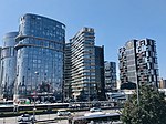
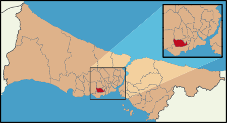
Yenibosna is a borough within the district of Bahçelievler in west Istanbul, Turkey. The borough is in the west of Bahçelievler, bordering with the neighbor district Küçükçekmece. The original settlement was initially named Saraybosna, the Turkish language name for the city Sarajevo, which had previously been under Turkish rule during the Ottoman Empire period. Saraybosna remained a small settlement despite being a short distance from Istanbul, the capital of Ottoman Empire, and the earliest population record was 350. The founding of Republic of Turkey saw rapid development of the area, which was absorbed into Istanbul and the current name of Yenibosna was adopted. The remains of the old settlement can be seen in the courtyard behind Yenibosna Primary School.

Excerpt from the Wikipedia article Yenibosna (License: CC BY-SA 3.0, Authors, Images).

Yenibosna
Zeki Müren Sokağı,

Geographical coordinates (GPS) Address Nearby Places
placeShow on map

Wikipedia: YenibosnaContinue reading on Wikipedia

Geographical coordinates (GPS)

Latitude Longitude
N 40.9975 ° E 28.850555555556 °
placeShow on map

Address

Zeki Müren Sokağı

Zeki Müren Sokağı
34188
Türkiye
mapOpen on Google Maps

Istanbul location Bahçelievler
Share experience

Nearby Places

Ataköy, Bakırköy
Ataköy, Bakırköy

Ataköy is a quarter of Bakırköy district in Istanbul Province, Turkey. It was developed as one of the first examples of satellite-city projects in Turkey. Ataköy is located in Bakırköy district on the European side of Istanbul. It is adjacent to Bahçelievler district and Şirinevler neighborhood. The area in the then outskirt of Istanbul City, which Ataköy today covers, belonged to the Turkish military, and was called Baruthane (literally: gunpowder magazine). In the 1950s, the government of Prime Minister Adnan Menderes (in office (1950–1960) transferred the property to the state-owned realty business bank Emlak Bank for envelopment as a satellite city of affordable housing for middle income households. In 1956, the project started with the construction of a beach site. The residence area was named "Ataköy" (literally "Atatürkville"). The project included 12,000 apartments, three hotels, beach, clubs, shopping malls, cultural center and sports facilities.Ataköy quarter consists of four neighborhoods with eleven sections of apartment blocks. The quarter is a peaceful residential area with wide green zones. The neighborhoods in the quarter are the Ataköy 1st Section, the 2nd-5th-6th Section, the 3rd-4th-11th Section and the 7th-8th-9th-10th Section. The 9th and 10th Sections were developed in 1986, and the 7th and 8th Sections were completed in 1990. In the recent years, some construction companies built residence blocks around the existing apartment blocks.Following facilities are situated in Ataköy: Yunus Emre Cultural Center, Conservatoty of Bakırköy Municipality, Ataköy Marina, Atrium Shopping Mall, Galleria Ataköy and Ataköy A Plus Shopping Mall, Sinan Erdem Dome, Ataköy Athletics Arena.