Rancho Bodega
California ranchosRanchos of Sonoma County, California

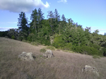
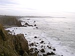
Rancho Bodega was a 35,487-acre (143.61 km2) Mexican land grant in present day Sonoma County, California given in 1844 by Governor Manuel Micheltorena to Stephen Smith. Bodega takes its name from the Peruvian explorer Juan Francisco de la Bodega y Quadra who discovered Bodega Bay in 1775. The grant extended along the Pacific coast from the Russian River on the north to Estero Americano on the south, and included the present-day town of Bodega Bay. Only a small part of Bodega is within the grant (most of Bodega in on Rancho Estero Americano).
Excerpt from the Wikipedia article Rancho Bodega (License: CC BY-SA 3.0, Authors, Images).Rancho Bodega
Coleman Valley Road,
Geographical coordinates (GPS) Address Nearby Places Show on map
Geographical coordinates (GPS)
| Latitude | Longitude |
|---|---|
| N 38.4 ° | E -123.03 ° |
Address
Coleman Valley Road
Coleman Valley Road
95419
California, United States
Open on Google Maps


