Duncans Point

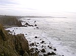
Duncans Point is a cape on the Pacific Coast of northern California in the United States. It is located in Sonoma County at 38.393°N 123.0947°W / 38.393; -123.0947, approximately 45 miles (70 km) northwest of San Francisco and approximately 20 miles (30 km) west of Santa Rosa. The point lies about halfway between Bodega Head (to the south) and Goat Rock (to the north). It is easily reached from State Route 1. The unincorporated community of Ocean View lies just north of the point. The peninsula, which is approximately 300 yd (300 m) long, emerges from the coast to the south. It shelters a rocky inlet, named Duncans Cove or Duncans Landing, which is part of the Sonoma Coast State Beach. Duncans Landing is notoriously dangerous, due to large waves and strong surf.
Excerpt from the Wikipedia article Duncans Point (License: CC BY-SA 3.0, Authors, Images).Duncans Point
Cliff Avenue,
Geographical coordinates (GPS) Address Nearby Places Show on map
Geographical coordinates (GPS)
| Latitude | Longitude |
|---|---|
| N 38.393 ° | E -123.0947 ° |
Address
Duncans Landing parking lot
Cliff Avenue
California, United States
Open on Google Maps


