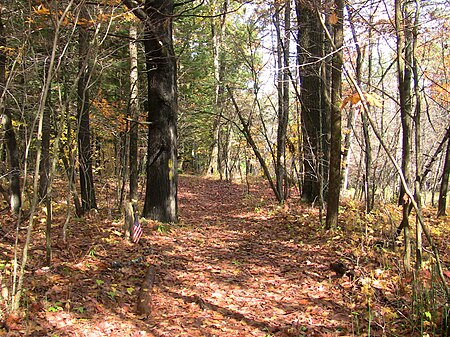
Crown Point Road

The Crown Point Road, or the Crown Point Military Road, is a historic road built in 1759-60, mostly in what is now the United States state of Vermont. It was built by British Army and colonial militia forces to connect Fort Crown Point near the southern end of Lake Champlain to the Fort at Number 4 in what is now Charlestown, New Hampshire. It was the first major road in Vermont, spurring development along its route after the French and Indian War. Fragments of the road are still visible in largely period condition, or have been paved over, while others have disappeared into the forest. Sections of the road located in Weathersfield have been listed on the National Register of Historic Places.
Excerpt from the Wikipedia article Crown Point Road (License: CC BY-SA 3.0, Authors, Images).Crown Point Road
Crown Point Road, Weathersfield
Geographical coordinates (GPS) Address Nearby Places Show on map
Geographical coordinates (GPS)
| Latitude | Longitude |
|---|---|
| N 43.391388888889 ° | E -72.503333333333 ° |
Address
Crown Point Road
Crown Point Road
05151 Weathersfield
Vermont, United States
Open on Google Maps


