place

Norfolk Crescent, Bath
Buildings and structures in Bath, SomersetGrade II* listed buildings in Bath, SomersetGrade II* listed houses in SomersetHouses completed in 1790Parks and open spaces in Bath, Somerset
Streets in Bath, SomersetUse British English from October 2013
Norfolk Crescent Bath

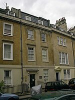
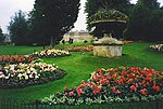
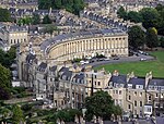
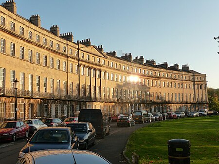
Norfolk Crescent in Bath, Somerset, England was built between c.1793 and c.1822 and has been designated as a Grade II* listed building. The original design was by John Palmer, but minor alterations were later made by John Pinch.The Georgian terrace includes numbers 1 to 7, which have been converted into flats known as Cumberland House, and numbers 8 to 18 consecutively. Each has five storeys (basement, ground floor, piano nobile, second floor and attic) and the central portion has 6 Ionic pilasters.There is a green area in front of the crescent that was originally a formal garden for the residents, surrounded by railings. A small circular building in the corner of the gardens is the old watchman's hut, and is also Grade II* listed.

Excerpt from the Wikipedia article Norfolk Crescent, Bath (License: CC BY-SA 3.0, Authors, Images).

Norfolk Crescent, Bath
Norfolk Crescent, Bath Kingsmead

Geographical coordinates (GPS) Address External links Nearby Places
placeShow on map

Wikipedia: Norfolk Crescent, BathContinue reading on Wikipedia

Geographical coordinates (GPS)

Latitude Longitude
N 51.3825 ° E -2.37 °
placeShow on map

Address

Norfolk Crescent

Norfolk Crescent
BA1 2BE Bath, Kingsmead
England, United Kingdom
mapOpen on Google Maps

linkWikiData (Q15262465)
linkOpenStreetMap (89760206)

Norfolk Crescent Bath
Share experience

Nearby Places

Kingsmead, Bath
Kingsmead, Bath

Kingsmead is an electoral ward within Bath, England, which encompasses most of Bath city centre and stretches west along the A4 to meet Newbridge and Weston wards. The ward elects two councillors to the Bath and North East Somerset unitary authority.Kingsmead is rarely used as the name of an area of Bath, and is primarily used for electoral purposes. The ward stretches about 1 mile (1.6 km) westward from Bath city centre, straddling the A4 road north of the River Avon. The ward is separated by the large Royal Victoria Park into a city centre eastern end, and a western residential end known as Lower Weston.A boundary review in 2018, which came into force at the May 2019 local elections, abolished Abbey ward and extended Kingsmead eastwards as far as the Avon to include most of the city centre. At the same time the ward's western extent was slightly reduced, in order to move the Chelsea Road shopping street wholly into Newbridge ward.Residents in the western end of the ward often use the facilities, such as schools, of the neighbouring Newbridge and Weston wards, and associate themselves with these localities.The closed Mangotsfield and Bath Branch Line formerly ran from Green Park station, now a shopping area, in the ward. The Bristol & Bath Railway Path runs through the ward, but on the River Avon path rather than the former railway track which has been developed upon just south of the ward. The electoral wards surrounding the ward are: Newbridge to the west, Weston and Lansdown to the north, Walcot and Bathwick to the east, and Widcombe & Lyncombe, Oldfield Park and Westmoreland to the south over the River Avon.

Westmoreland, Bath

Westmoreland is an area and electoral ward in the south-west of Bath, England. Although still shown on some Ordnance Survey mapping, Westmoreland is rarely used by residents as the name of an area of Bath, and is primarily used for electoral purposes within the Bath and North East Somerset unitary authority, electing two councillors.The name Westmoreland is probably derived from the house, Westmoreland Place (see 1818 and 1852 maps of Bath), that stood approximately where Westmoreland Street is today. Boundary changes for the electoral wards in Bath most recently took place at the May 2019 elections; Westmoreland remained a ward but with altered boundaries. At that election, Westmoreland elected two independents, and was the only ward in the city not to return Liberal Democrats. Confusingly Westmoreland Street, Westmoreland Drive and Westmoreland Road, as well as the former Westmoreland goods station which closed in 1967, are not in the present-day ward, but about half a kilometre away in Oldfield Park ward.Conversely, Oldfield Park railway station and a part of the Oldfield Park residential area, including Moorland Road which is a shopping district, is located in Westmoreland ward. Also in the ward is East Twerton and the one end of the Two Tunnels Greenway.The wards surrounding Westmoreland ward are: Oldfield Park to the east, Moorlands and Southdown to the south, Twerton to the west, and Newbridge and Kingsmead to the north over the River Avon, which forms the ward's northern boundary.Westmoreland has a considerable student population, from the University of Bath and Bath Spa University, both in private rental, and for Bath Spa University students accommodation blocks on former industrial land by the River Avon.