place

River Leadon

England river stubsRivers of GloucestershireRivers of HerefordshireSevern drainage basinTributaries of the River Severn
Use British English from October 2017
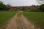
The River Leadon from Wedderburn Bridge geograph.org.uk 685717

The River Leadon () is a river in Herefordshire and Gloucestershire, England, a tributary of the River Severn. It rises just south of the village of Acton Beauchamp, and flows south past Bosbury to the town of Ledbury, which takes its name from the river. It then flows south and east past Dymock, Upleadon and Highleadon to join the Severn at Over, just west of Gloucester. The river is approximately 32 miles (51 km) long.The name is of Celtic origin, and means "broad stream".In the Middle Ages, the Leadon flowed in two branches for the last two miles. The main stream, known as the New Leadon, flowed south of Over to join the river south of Over Bridge. The river was prone to flooding, and to alleviate the problem the river was diverted in 1867 to flow along the branch previously known as the Old Leadon, and now the only course of the river, flowing into the Severn north of Over.The Herefordshire and Gloucestershire Canal was built through the valley of the Leadon in 1795, and converted into the Ledbury and Gloucester Railway in the 1880s.

Excerpt from the Wikipedia article River Leadon (License: CC BY-SA 3.0, Authors, Images).

Geographical coordinates (GPS)

Latitude Longitude
N 51.8778 ° E -2.2675 °
placeShow on map

Address

A417
GL2 8ES , Maisemore
England, United Kingdom
mapOpen on Google Maps

The River Leadon from Wedderburn Bridge geograph.org.uk 685717
Share experience

Nearby Places

Over Bridge
Over Bridge

Over Bridge, also known as Telford's Bridge, is a single span stone arch bridge spanning the canalised West Channel of the River Severn near Gloucester, England. It links Over to Alney Island. Although there was a crossing at Over recorded in the Domesday Book, this bridge was built by Thomas Telford between 1825 and 1828, to carry traffic east-west. It was opened in 1830 and remained in use for traffic until 1974. Until the Severn Bridge was built in the 1960s, this was the lowest point downstream that the Severn could be crossed by road bridge. The arch spans 150 ft (46 m), and was based on Jean-Rodolphe Perronet's 1774 design for a bridge over the River Seine at Neuilly. It combines both an elliptical profile over most of the soffit with a segmental profile at its faces. This feature is known as a corne de vache. When built, the arch sank by 2 in (5.1 cm) when its timber centering was removed, and another 8 in (20 cm) due to settlement of the arch foundations. Today it is a pedestrian-only bridge, and is in the guardianship of Historic England as a scheduled ancient monument. Road traffic on the A40 crosses the Severn on a new bridge alongside and upstream of it. This is the last road bridge over the Severn before the Severn Crossings, and was the most downstream free crossing until tolls were removed from the Severn Bridge and Second Severn Crossing in December 2018, although the Severn Bridge already had free access for pedestrians, cyclists and mopeds and, as previously stated, there is no vehicular access to Over Bridge. The bridge is connected by segregated bicycle paths around Alney Island, to Highnam and Gloucester. The Over Bridge can be seen from the train travelling from Gloucester on the way to Lydney or Chepstow on the Gloucester to Newport section of the former South Wales Railway.