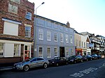
Walham
Gloucestershire geography stubsUse British English from March 2015Villages in Gloucestershire

Walham is a village in Longford parish, north of Gloucester, England. It lies on the banks of the River Severn and north of the A40 road. A National Grid substation, providing power to half a million homes and the Government Communications Headquarters (GCHQ), is situated at Walham. The substation came to national prominence in July 2007, when it was threatened by a major flood. The fire service and military stopped the flood waters two inches below the height at which the plant would flood. This struggle with nature was dubbed the "Battle for Walham" in national newspapers.
Excerpt from the Wikipedia article Walham (License: CC BY-SA 3.0, Authors, Images).Walham
A40, Gloucester Kingsholm
Geographical coordinates (GPS) Address Nearby Places Show on map
Geographical coordinates (GPS)
| Latitude | Longitude |
|---|---|
| N 51.878888888889 ° | E -2.2505555555556 ° |
Address
A40
GL2 9AQ Gloucester, Kingsholm
England, United Kingdom
Open on Google Maps


