Wadsworth, West Yorkshire
Civil parishes in West YorkshireGeography of CalderdaleWest Yorkshire geography stubs

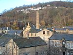
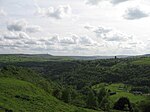
Wadsworth is a civil parish in the Metropolitan Borough of Calderdale in West Yorkshire, England. It has a population of 1,456, increasing to 1,603 at the 2011 Census, and was, until 1974, part of Hepton Rural District. Historically part of the West Riding of Yorkshire, the main settlements in the parish are Old Town, Chiserley and Pecket Well. It was named a berewick of Wakefield in the Domesday Book of 1086, and thus subsequently recorded as a subinfeudatory manor, before its subsequent extinguishment in the nineteenth century. From the seventeenth century it was also one of five townships forming the chapelry of Heptonstall.
Excerpt from the Wikipedia article Wadsworth, West Yorkshire (License: CC BY-SA 3.0, Authors, Images).Wadsworth, West Yorkshire
Westfield, Calderdale Wadsworth
Geographical coordinates (GPS) Address Nearby Places Show on map
Geographical coordinates (GPS)
| Latitude | Longitude |
|---|---|
| N 53.75 ° | E -2 ° |
Address
Westfield
Westfield
HX7 8SH Calderdale, Wadsworth
England, United Kingdom
Open on Google Maps


