place

Pitt River Bridge

Bridges completed in 1957Bridges completed in 2009Bridges in Greater VancouverCable-stayed bridges in CanadaDemolished buildings and structures in British Columbia
Pitt MeadowsPort CoquitlamRoad bridges in British ColumbiaSwing bridges in Canada
Pitt River Bridge 2016

The Pitt River Bridge is a cable-stayed bridge that spans the Pitt River between Port Coquitlam and Pitt Meadows in British Columbia, Canada. The bridge is part of Highway 7, carrying Lougheed Highway across the river. The current bridge opened on October 4, 2009. The bridge includes a 380 m cable stay bridge structure, 126 m of multi-span approaches, a 50 m interchange structure and approximately 2 km of grade construction. Total project cost for the bridge was $200 million

Excerpt from the Wikipedia article Pitt River Bridge (License: CC BY-SA 3.0, Authors, Images).

Pitt River Bridge
PItt River Bridge Bike Path,

Geographical coordinates (GPS) Address Website External links Nearby Places
placeShow on map

Wikipedia: Pitt River BridgeContinue reading on Wikipedia

Geographical coordinates (GPS)

Latitude Longitude
N 49.2482 ° E -122.7297 °
placeShow on map

Address

Pitt River Bridge

PItt River Bridge Bike Path
V3B 0L4
British Columbia, Canada
mapOpen on Google Maps

Website
infrastructurebc.com

linkVisit website

linkWikiData (Q7199083)
linkOpenStreetMap (742056675)

Pitt River Bridge 2016
Share experience

Nearby Places

Terry Fox Secondary School

Terry Fox Secondary School is a school with approximately 1550 students in Port Coquitlam, British Columbia, Canada. The original building was built in the 1950s under the name "Port Coquitlam Senior Secondary" for grades 11 and 12. In 1986, it was renamed Terry Fox Senior Secondary School after 1976 graduate Terry Fox. The "Senior" was dropped from the name after a restructuring by Coquitlam School District 43, when junior high schools were replaced by middle schools. Terry Fox Secondary's Code of Conduct is compatible with the District Code of Conduct, The BC Human Rights Code, and they also acknowledge their own four pillars of Leadership, Integrity, Kindness, and Perseverance. In 1999, to help deal with the growing population, the school was relocated to a new, larger building, several kilometres away on Riverwood Gate. However, the new building quickly became overpopulated as well, and is now home to 17 portables. Fox offers a wide variety of academic courses and programs at all levels. Creating community is always a focus with dynamic leadership courses and initiatives to build connections in and out of our building. The school offers many honors classes as well as Advanced Placement and Co-op programs and Ace It programs. The School has respected athletic programs, namely in basketball and football, and is usually ranked in both sports.The Terry Fox football team has also taken part in an exchange with the football team from St. Mark Catholic High School (Ottawa) from Manotick, Ontario since 2009. The Terry Fox Theatre, a privately run operation, formerly run by the school itself, adjoins the north side of the school. The school is noted for its many musicals and plays including You're a Good Man, Charlie Brown, Footloose, Hair, The Wedding Singer and Jesus Christ Superstar, Tough, Daddy's Home, The Effect of Gamma Rays on Man-in-the-Moon Marigolds, Of Mice and Men and The 25th Annual Putnam County Spelling Bee. In 2010, Terry Fox Secondary became District Champions of "MetFest" with the musical comedy The 25th Annual Putnam County Spelling Bee, going on to represent Terry Fox Secondary at the Sears British Columbia Drama Festival] where they were awarded 'Best Actor in a Leading Role - Female', 'Special Merit Award for Musical Virtuosity', and 'Best Ensemble/ Choreography'. In 2011, Terry Fox's show "Am I Blue" became District Champions at "MetFest".

Pitt River
Pitt River

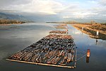
The Pitt River in British Columbia, Canada is a large tributary of the Fraser River, entering it a few miles upstream from New Westminster and about 25 km ESE of Downtown Vancouver. The river, which begins in the Garibaldi Ranges of the Coast Mountains, is in two sections above and below Pitt Lake and flows on a generally southernly course. Pitt Lake and the lower Pitt River are tidal in nature as the Fraser's mouth is only a few miles downstream from their confluence. The river was named for William Pitt the Younger. The first mention of the name, as "Pitts River", occurs in the 1827 journal kept by James McMillan of the Hudson's Bay Company. The river has an alternate name, Quoitle, which is probably equivalent to Kwantlen.East of the lower Pitt River, 20 km long, is the community of Pitt Meadows, while to its west are the cities of Coquitlam and Port Coquitlam; opposite its mouth is Surrey. Port Coquitlam and Pitt Meadows are connected by the Highway 7 bridges and the rail trestles of the double-tracked CPR mainline, whose vast main western yards begin on the Pitt's western shore. The plain of the lower Pitt was berry marsh and bog prior to its dyking. The farmland is on the east bank in Pitt Meadows; the poorer soil quality and scrubland on the west shore has encouraged largescale suburbanization in Port Coquitlam. On the west shore in the upper stretches of the lower Pitt is Minnekhada Regional Park, residence of former British Columbia lieutenant-governor Clarence Wallace. It was later sold to the Daon Corporation, which sold off portions. The Province then bought it, anticipating future development in the area; future provincial governments sold off even more portions. The upper Pitt's basin is short but fed by a number of ice fields, glaciers, and mountain streams, such as Garibaldi Névé and Mamquam Icefield. Thus the river gets quite large only 50 km from its source in Garibaldi Provincial Park. East of the upper Pitt is Golden Ears Provincial Park (formerly a part of Garibaldi Provincial Park). Barge traffic from logging camps in the upper Pitt basin is a regular sight on the Pitt Lake as well as in the area of the two highway bridges and CPR mainline bridge just up from the confluence of the Fraser. The Pitt is one of a number of north-south river-lake valleys which join the lower Fraser along its north side. The others are the valleys of the Coquitlam River, the Alouette River, the Stave River, Suicide Creek (Norrish Creek), the Chehalis River and, lastly, the valley of Harrison Lake, 60 km east of the Pitt.