place

Lillie Bridge Grounds

1867 establishments in EnglandBuildings and structures in the London Borough of Hammersmith and FulhamCricket grounds in LondonCricket in MiddlesexDefunct athletics (track and field) venues in England
Defunct boxing venuesDefunct cricket grounds in EnglandDefunct football venues in EnglandDefunct sports venues in LondonEngvarB from June 2013FA Cup Final venuesFormer buildings and structures in the London Borough of Hammersmith and FulhamFulhamHistory of the London Borough of Hammersmith and FulhamSport in Hammersmith and FulhamSports venues completed in 1867
Charles Booth 1889 map detail showing Lillie Bridge

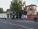
The Lillie Bridge Grounds was a sports ground on the Fulham side of West Brompton, London. It opened in 1866, coinciding with the opening of West Brompton station. It was named after the local landowner, Sir John Scott Lillie (1790–1868) and the Lillie bridge over the West London Line, that links Old Brompton Road with Lillie Road. The grounds were adjacent to the railway on the south side of Lillie Road. Although geographically near to present day Stamford Bridge, there was never direct access, there being the 13 acre now defunct Western Hospital site between the two. The ground was the scene in its day of many sports including athletics, boxing, cricket, cycling and football, and hosted the FA Cup Final in 1873. It closed in 1888 following a riot reported in The Times.

Excerpt from the Wikipedia article Lillie Bridge Grounds (License: CC BY-SA 3.0, Authors, Images).

Lillie Bridge Grounds
Lillie Square, London Walham Green (London Borough of Hammersmith and Fulham)

Geographical coordinates (GPS) Address Nearby Places
placeShow on map

Wikipedia: Lillie Bridge GroundsContinue reading on Wikipedia

Geographical coordinates (GPS)

Latitude Longitude
N 51.4854 ° E -0.1943 °
placeShow on map

Address

Lillie Square East

Lillie Square
SW6 1DZ London, Walham Green (London Borough of Hammersmith and Fulham, Lillie Square)
England, United Kingdom
mapOpen on Google Maps

Charles Booth 1889 map detail showing Lillie Bridge
Share experience

Nearby Places

Fulham
Fulham

Fulham () is an area of the London Borough of Hammersmith & Fulham in West London, England, 3.6 miles (5.8 km) southwest of Charing Cross. It lies on the north bank of the River Thames, bordering Hammersmith, Kensington and Chelsea. The area faces Wandsworth, Putney, Barn Elms and the London Wetland Centre in Barnes. on the far side of the river. First recorded by name in 691, Fulham was a manor and ancient parish which originally included Hammersmith. Between 1900 and 1965, it was the Metropolitan Borough of Fulham, before its merger with the Metropolitan Borough of Hammersmith created the London Borough of Hammersmith and Fulham. The district is split between the western and south-western postal areas. Fulham has a history of industry and enterprise dating back to the 15th century, with pottery, tapestry-weaving, paper-making and brewing in the 17th and 18th centuries in present-day Fulham High Street, and later involvement in the automotive industry, early aviation, food production, and laundries. In the 19th-century there was glass-blowing and this resurged in the 21st century with the Aronson-Noon studio and the former Zest gallery in Rickett Street. Lillie Bridge Depot, a railway engineering depot opened in 1872, is associated with the building and extension of the London Underground, the electrification of Tube lines from the nearby Lots Road Power Station, and for well over a century has been the maintenance hub for rolling stock and track.Two football clubs, Fulham and Chelsea, play in Fulham. Two other notable sporting clubs are the Hurlingham Club, known for polo, and the Queen's tennis club, known for its annual pre-Wimbledon tennis tournament. In the 1800s, Lillie Bridge Grounds hosted the first meetings of the Amateur Athletic Association of England, the second FA Cup Final, and the first amateur boxing matches. The Lillie Bridge area was the home ground of the Middlesex County Cricket Club, before it moved to Marylebone.

Old Brompton Road
Old Brompton Road

Old Brompton Road is a major street in the South Kensington district of The Royal Borough of Kensington and Chelsea, London. It starts from South Kensington Underground station and runs south-west, through a mainly residential area, until it reaches West Brompton and the area around Earl's Court tube station. It runs through the SW5 and SW7 postcodes. There are several 5-star hotels and upmarket shops along the road. One of the most famous auction houses in the world, Christie's, was located near the eastern end of the road at number 85. The Coleherne pub (now The Pembroke), located at number 261, has become infamous for being the stalking ground for three serial killers, Dennis Nilsen, Michael Lupo and Colin Ireland. It is also mentioned in the song 'Hanging Around' by The Stranglers, as well as in Armistead Maupin's Tales of the City book Babycakes. Another landmark of the road is the Troubadour which has been a cultural hub for over fifty years. The coffee-house above, now a restaurant, has hosted the founding of Private Eye and the writing of many books, while the club below has been a venue for Bob Dylan and Adele. The Drayton Arms is a Grade II listed pub and theatre at number 153. The most famous resident was Diana, Princess of Wales before her 1981 engagement and subsequent marriage to Charles, Prince of Wales. She shared a flat with three others before subsequently moving on to Clarence House. The road is sometimes confused with Brompton Road which lies further to the east, in Knightsbridge.