place

Nuris

1948 disestablishments in Mandatory PalestineArab villages depopulated during the 1948 Arab–Israeli WarDistrict of JeninFormer populated places in IsraelFormer populated places in the State of Palestine
Pages with non-numeric formatnum arguments
JezreelValley
JezreelValley

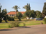
Nuris (Arabic: نورِِِس) was a Palestinian Arab village in the District of Jenin. In 1945, Nuris had 570 inhabitants. It was depopulated during the 1948 War on 29 May 1948 under Operation Gideon. The Israeli moshav of Nurit was built on Nuris' village land in 1950.

Excerpt from the Wikipedia article Nuris (License: CC BY-SA 3.0, Authors, Images).

Nuris
Nof Gilboa, Gilboa Regional Council

Geographical coordinates (GPS) Address Nearby Places
placeShow on map

Wikipedia: NurisContinue reading on Wikipedia

Geographical coordinates (GPS)

Latitude Longitude
N 32.535 ° E 35.363611111111 °
placeShow on map

Address

עין נורית

Nof Gilboa
Gilboa Regional Council
North District, Israel
mapOpen on Google Maps

JezreelValley
JezreelValley
Share experience

Nearby Places

Battle of Ain Jalut
Battle of Ain Jalut

The Battle of Ain Jalut (Arabic: معركة عين جالوت, romanized: Ma'rakat ‘Ayn Jālūt), also spelled Ayn Jalut, was fought between the Bahri Mamluks of Egypt and the Mongol Empire on 3 September 1260 (25 Ramadan 658 AH) near the spring of Ain Jalut in southeastern Galilee in the Jezreel Valley. Continuing the westward expansion of the Mongol Empire, the armies of Hulagu Khan captured and sacked Baghdad in 1258, along with the Ayyubid capital of Damascus sometime later. Hulagu sent envoys to Cairo demanding Qutuz surrender Egypt, to which Qutuz responded by killing the envoys and displaying their heads on the Bab Zuweila gate of Cairo. Shortly after this, Möngke Khan was slain in battle against the Southern Song. Hulagu returned to Mongolia with the bulk of his army to attend the kurultai in accordance with Mongol customs, leaving approximately 10,000 troops west of the Euphrates under the command of Kitbuqa. Learning of these developments, Qutuz quickly advanced his army from Cairo towards Palestine. Kitbuqa sacked Sidon, before turning his army south towards the Spring of Harod to meet Qutuz' forces. Using hit-and-run tactics and a feigned retreat by Mamluk general Baibars, combined with a final flanking maneuver by Qutuz, the Mongol army was forced to retreat toward Bisan, after which the Mamluks led a final counterattack, which resulted in the deaths of many Mongols, including Kitbuqa himself. The battle has been cited as the first time the Mongols were permanently prevented from expanding their influence; It also marked the first of two defeats the Mongols would face in their attempts to invade Egypt and the Levant, the other being the Battle of Marj al-Saffar in 1303. The earliest known use of the hand cannon in any military conflict is also documented to have taken place in this battle by the Mamluks, who used it to frighten the Mongol armies, according to Arabic military treatises of the 13th and 14th centuries.

Ma'ayan Harod
Ma'ayan Harod

Ma'ayan Harod (Hebrew: מעיין חרוד, lit. 'Harod's spring') or Ain Jalut (Arabic: عين جالوت ‘ayn Jālūt, or عين جالود ‘ayn Jālūd, and Hebrew: גילות, romanized: ain djeluth) is an all-year spring in the Jezreel Valley on the northwest corner of Mount Gilboa that was the location of the 13th-century Battle of Ain Jalut. This was a major turning point in world history that saw the Mamluks inflict the first of two defeats on the Mongols that ultimately halted their invasion of the Levant and Egypt.The traditional name of Ain Jalut has been in use since the 12th century, and is commonly believed to mean "Spring of Goliath", although alternative etymologies have suggested that it might be derived from the name Gilead, potentially an archaic name for Mount Gilboa. Other names given to the site include "En Harod" or "Ein Harod", a biblical place name that was associated with Ain Jalut in the 19th century, though subsequent scholarship, specifically the work of Israel Finkelstein and Oded Lipschits, has refuted this connection. Other associations have also been suggested, including in the 1841 Biblical Researches in Palestine, which linked it to the "spring in Jezreel" where Saul pitched his tent before his final battle, but this was rejected in 1847 and has gained little traction since. The spring is still sometimes known as the "Fountain of Jezreel", as well as "Gideon's Fountain".According to the medieval chronicler Baha ad-Din ibn Shaddad there was a prosperous village at the site in the Middle Ages. It was captured by the Crusaders and retaken by Saladin in 579. A later Palestinian village was also established in the area in the late 19th century. In the 1920s, the Zionist activist Yehoshua Hankin purchased the surrounding area as part of the Sursock Purchases through the Palestine Land Development Company, and founded a kibbutz, which he called Ein Harod, near the spring. The site is today incorporated into the Ma'ayan Harod National Park, administered by the Israel Nature and Parks Authority.