Ghabat Kafr Sur
Arab villages depopulated during the 1948 Arab–Israeli WarDistrict of TulkarmPages with non-numeric formatnum argumentsWikipedia extended-confirmed-protected pages

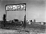
Ghabat Kafr Sur was a Palestinian village in the Tulkarm Subdistrict of Mandatory Palestine. It was depopulated during the 1948 Arab–Israeli War on May 15, 1948, under Operation Coastal Clearing. It was located 16 km southwest of Tulkarm.
Excerpt from the Wikipedia article Ghabat Kafr Sur (License: CC BY-SA 3.0, Authors, Images).Ghabat Kafr Sur
Yad Harutzim, Netanya Kiryat Nordau
Geographical coordinates (GPS) Address Nearby Places Show on map
Geographical coordinates (GPS)
| Latitude | Longitude |
|---|---|
| N 32.283888888889 ° | E 34.8675 ° |
Address
דואר שליחים EMS
Yad Harutzim
4250519 Netanya, Kiryat Nordau
Center District, Israel
Open on Google Maps


