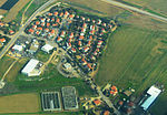
Zayta, Hebron

Zayta (Arabic: زيْتا Zaytā) was a Palestinian Arab village in the Hebron Subdistrict in Mandate Palestine. During Crusader rule in Palestine, the village is mentioned as forming part of the landholdings of the Order of St. John. At the time of the rule of the Ottoman Empire, according to the 1596 census, Zayta had a population of 165. Mentioned by Western travellers to the region in the 19th century, it is described by one as, "a picturesque Arab village"; by 1945, its population was 330 inhabitants. Until the period of Mandatory Palestine, the village was located at what is known in modern Israel as Tel Zayit; its population was moved 1.5 km north due to the nearby stagnant waters. In 2005, archeologists discovered the Zayit Stone in an excavated limestone wall. The new Zayta village was depopulated during the 1948 Arab-Israeli War between July 17–18, 1948. Its inhabitants became refugees, ending up the West Bank and Gaza Strip. All that remains of the village structures is the well that served as its main water source.
Excerpt from the Wikipedia article Zayta, Hebron (License: CC BY-SA 3.0, Authors, Images).Zayta, Hebron
353, Yoav Regional Council
Geographical coordinates (GPS) Address Nearby Places Show on map
Geographical coordinates (GPS)
| Latitude | Longitude |
|---|---|
| N 31.640277777778 ° | E 34.823611111111 ° |
Address
מגדל שמירה
353
8202280 Yoav Regional Council
South District, Israel
Open on Google Maps


