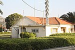
Khirbat Al-Manara
Arab villages depopulated during the 1948 Arab–Israeli WarDistrict of HaifaPalestine geography stubs

Khirbat Al-Manara was a Palestinian Arab village in the Haifa Subdistrict. It was depopulated during the 1948 Arab-Israeli War on May 21, 1948. It was located 19 km south of Haifa.
Excerpt from the Wikipedia article Khirbat Al-Manara (License: CC BY-SA 3.0, Authors, Images).Khirbat Al-Manara
Old Coastal highway, Hof HaCarmel Regional Council
Geographical coordinates (GPS) Address Nearby Places Show on map
Geographical coordinates (GPS)
| Latitude | Longitude |
|---|---|
| N 32.645555555556 ° | E 34.964444444444 ° |
Address
מרכז מיר"ב
Old Coastal highway
3085000 Hof HaCarmel Regional Council
Haifa District, Israel
Open on Google Maps


