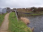
Clayhanger is a residential area of Brownhills, West Midlands, England.
It is located in the north of the Metropolitan Borough of Walsall, approximately five miles north of Walsall in an area which was part of Aldridge-Brownhills Urban District until 1974.
Many of the houses in the area are privately owned and were built from 1995 to 2005 with the sale of various farm land at opposite sides of the village. For instance, the 'Swingbridge Park' development built by Maunders (then Westbury following the purchase of the former) was built on Victorian Foot & Mouth burial grounds. The same development promised a public house on the former Swingbridge Farm site on Northfields Way, but the project was never delivered when initially given planning permission, then later applications were denied. The village remains 'dry' and without any public house.
Clayhanger is locally infamous for being an island - you cannot get in or out without crossing water. The village historically was also subject to flooding, especially the old railway line. The new developments have put a stop to this.
The village is only accessible from two entrance points one via Bridge Street, named for the old railway bridge that passed over the main road just by the now painted 'spot' traffic island, and via Clayhanger Lane, that still has the Railway bridge that was one part of the South Staffordshire Line. The line itself is now used for walkers & cyclists. The Bridge Street entrance is also home to Clayhanger Common. The common was originally home to a council run waste disposal site from the 1950s up until the early 1980s. This has a bad effect on the village to the point in 1975 residents were given rate reductions as compensation.
The average house price in the Village was £177,400 as of June 2014 However, houses each side of the Ford Brook are of different ages.
Clayhanger did not receive a dedicated bus service until 1986. The service remains indifferent at best today.
Clayhanger remains the home of Edmund Howdle Butchers, a long established traditional family Butchers. It also enjoys a Co-Operative mini-market along with independent traders Alpha Hair Design, Clayhanger Fish & Chips & The New Jade Garden Chinese takeaway. These were built on the site of a derelict former factory on Clayhanger Lane.
Holy Trinity C of E School, for children up to year 6 (age 11) continues to operate on Church Street.
In November 2016 Northfields Way was finally closed by Walsall MBC at the junction of Allerdale Road to stop anti-social behaviour.
"Clayhanger" was mentioned in the lands of the Earl of Stafford in 1391


