Fiddler's Reach Fog Signal
Buildings and structures on the National Register of Historic Places in MaineKennebec RiverNational Register of Historic Places in Sagadahoc County, MaineNavigational aidsTowers completed in 1914 ... and 3 more
Transport infrastructure completed in 1914Transportation buildings and structures in Sagadahoc County, MaineUse mdy dates from August 2023

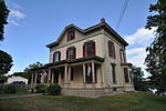
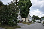
The Fiddler's Reach Fog Signal is a fog signal station located on the Kennebec River in Arrowsic, Maine, in Sagadahoc County. It is about 1,100 feet (340 m) SW of the front light of the Doubling Point Range Lights, and about 2,000 feet (610 m) east of Doubling Point Light. The pyramidal bell structure was built in 1914, two years after a large steamship, the Ransom B. Fuller, ran aground in the fog on this section of the river.
Excerpt from the Wikipedia article Fiddler's Reach Fog Signal (License: CC BY-SA 3.0, Authors, Images).Fiddler's Reach Fog Signal
Doubling Point Road,
Geographical coordinates (GPS) Address External links Nearby Places Show on map
Geographical coordinates (GPS)
| Latitude | Longitude |
|---|---|
| N 43.881611111111 ° | E -69.799305555556 ° |
Address
Fiddler's Reach Fog Signal
Doubling Point Road
04530
Maine, United States
Open on Google Maps


