place

Agate Lake

1966 establishments in OregonAC with 0 elementsBuildings and structures in Jackson County, OregonDams completed in 1966Dams in Oregon
Lakes of Jackson County, OregonProtected areas of Jackson County, OregonReservoirs in OregonUnited States Bureau of Reclamation dams
Agate Lake
Agate Lake

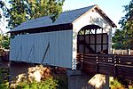
Agate Lake is a reservoir located 1,510 feet (460 m) above sea level in Jackson County, Oregon, United States. It is 13 miles (21 km) northeast of Medford, just north of Roxy Ann Peak. The lake is formed by the 86-foot (26 m) tall Agate Dam, which impounds Dry Creek, in the Rogue River watershed.

Excerpt from the Wikipedia article Agate Lake (License: CC BY-SA 3.0, Authors, Images).

Agate Lake
Agate Dam Access Road,

Geographical coordinates (GPS) Address Nearby Places
placeShow on map

Wikipedia: Agate LakeContinue reading on Wikipedia

Geographical coordinates (GPS)

Latitude Longitude
N 42.410847222222 ° E -122.77045833333 °
placeShow on map

Address

Agate Dam Access Road

Agate Dam Access Road

Oregon, United States
mapOpen on Google Maps

Agate Lake
Agate Lake
Share experience

Nearby Places

Roxy Ann Peak
Roxy Ann Peak

Roxy Ann Peak, also known as Roxy Ann Butte, is a 3,576-foot-tall (1,090 m) mountain in the Western Cascade Range at the eastern edge of Medford, Oregon. Composed of several geologic layers, the majority of the peak is of volcanic origin and dates to the early Oligocene epoch. It is primarily covered by oak savanna and open grassland on its lower slopes, and mixed coniferous forest on its upper slopes and summit, stopping short of the summit. Despite the peak's relatively small topographic prominence of 753 feet (230 m), it rises 2,200 feet (670 m) above Medford and is visible from most of the Rogue Valley. The mountain is Medford's most important viewshed, open space reserve, and recreational resource. The area was originally inhabited beginning 8,000 to 10,000 years ago by ancestral Native Americans. The Latgawa Native American tribe was present in the early 1850s when the sudden influx of non-indigenous settlers resulted in the Rogue River Wars. After the wars, the Latgawa were forced away from the region onto reservations. The peak was named in August 1853 by emigrants arriving from Missouri via the Oregon Trail. Roxy Ann Hutchinson Hughes Bowen was the (step)grandmother of the McKee-Bowen family. Her step-daughter Maryum Bowen and Maryum's husband John McKee settled on, and filed a Donation Land Claim for, 320 acres on the SW flank of the butte (today's Hillcrest Orchards and Roxy Ann Vineyards). In 1883, the city of Medford was established to the southwest of the mountain, and became incorporated two years later. After acquiring a large amount of land from the Lions Club and the federal government between 1930 and 1933, the city created the 1,740-acre (700 ha) Prescott Park in 1937. The park protects much of the upper slopes and summit of the peak and remains largely undeveloped. The peak's southern foothills have some quickly expanding single-family residential subdivisions.