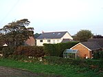
Haskayne
Geography of the Borough of West LancashireLancashire geography stubsUse British English from July 2014Villages in Lancashire

Haskayne is a small village in the county of Lancashire, England, and on the West Lancashire Coastal Plain. It is to the north of Downholland Cross on the A5147 and the Leeds and Liverpool Canal. The village is in Downholland civil parish, and forms part of the Aughton & Downholland ward, which is represented by three Conservative Party councillors and is part of the district of West Lancashire.
Excerpt from the Wikipedia article Haskayne (License: CC BY-SA 3.0, Authors, Images).Haskayne
Queens Green, West Lancashire Downholland
Geographical coordinates (GPS) Address Nearby Places Show on map
Geographical coordinates (GPS)
| Latitude | Longitude |
|---|---|
| N 53.565 ° | E -2.968 ° |
Address
Queens Green
Queens Green
L39 7JH West Lancashire, Downholland
England, United Kingdom
Open on Google Maps


