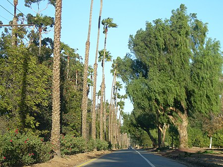
Victoria Avenue (Riverside, California)
California road stubsHistory of Riverside County, CaliforniaLandmarks in Riverside, CaliforniaNational Register of Historic Places in Riverside County, CaliforniaRiverside County, California geography stubs ... and 4 more
Roads on the National Register of Historic Places in CaliforniaSouthern California Registered Historic Place stubsStreets in Riverside County, CaliforniaTransportation in Riverside, California

Victoria Avenue is a divided scenic street in Riverside, California, that cuts through an area referred to as the greenbelt. Originally developed in 1892 to connect the Arlington Heights area to downtown Riverside, the road became a popular tourist attraction because of the many trees and exotic plants used to landscape the route. Beyond the landscaping, the road was surrounded by navel orange groves, the crop that spurred Riverside's growth. Many of the groves still exist today.
Excerpt from the Wikipedia article Victoria Avenue (Riverside, California) (License: CC BY-SA 3.0, Authors, Images).Victoria Avenue (Riverside, California)
Bloom Way, Riverside Casa Blanca
Geographical coordinates (GPS) Address Nearby Places Show on map
Geographical coordinates (GPS)
| Latitude | Longitude |
|---|---|
| N 33.925833333333 ° | E -117.39916666667 ° |
Address
Bloom Way 7576
92506 Riverside, Casa Blanca
California, United States
Open on Google Maps


