Ill Crag
Cumbria geography stubsFells of the Lake DistrictFurthsHewitts of EnglandMountains under 1000 metres ... and 1 more
Nuttalls

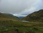
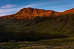
Ill Crag is a fell in the English Lake District. At 935 metres (3,068 ft), it is the fourth-highest peak in England, after Scafell Pike, Sca Fell, and Helvellyn. Ill Crag overlooks Eskdale and has splendid views across to Bowfell and Crinkle Crags.
Excerpt from the Wikipedia article Ill Crag (License: CC BY-SA 3.0, Authors, Images).Ill Crag
Geographical coordinates (GPS) Address Nearby Places Show on map
Geographical coordinates (GPS)
| Latitude | Longitude |
|---|---|
| N 54.45512 ° | E -3.19998 ° |
Address
Pen
, Eskdale
England, United Kingdom
Open on Google Maps


