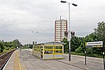
Ford, Merseyside
Merseyside geography stubsTowns and villages in the Metropolitan Borough of Sefton

Ford is an area and electoral ward in the borough of Sefton, Merseyside, North West England. The population of Ford taken at the 2011 census was 12,731.Ford is situated to the east of Crosby next to Rimrose Valley, and north of Litherland and is in the L21 postcode.
Excerpt from the Wikipedia article Ford, Merseyside (License: CC BY-SA 3.0, Authors, Images).Ford, Merseyside
Townsend View,
Geographical coordinates (GPS) Address Nearby Places Show on map
Geographical coordinates (GPS)
| Latitude | Longitude |
|---|---|
| N 53.481 ° | E -2.997 ° |
Address
Townsend View
Townsend View
L21 0EA , Ford
England, United Kingdom
Open on Google Maps


