Littlecote, Buckinghamshire
Buckinghamshire geography stubsDeserted medieval villages in BuckinghamshireForcibly depopulated communities in the United KingdomHamlets in BuckinghamshireOpenDomesday ... and 1 more
Use British English from December 2021

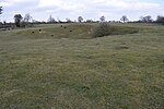
Littlecote, in the English county of Buckinghamshire, also known as Lidcote, was a village about eight miles north of Aylesbury. A settlement with ten households was recorded in the Domesday Book of 1086. In the late 15th century, the landowner, Thomas Pigott, started to enclose land for sheep grazing, which was for him a profitable use of the land. By 1507, enclosure had been completed and the village had been depopulated and destroyed.The present settlement consists of a farm and a dispersed hamlet, in Stewkley parish.
Excerpt from the Wikipedia article Littlecote, Buckinghamshire (License: CC BY-SA 3.0, Authors, Images).Littlecote, Buckinghamshire
Geographical coordinates (GPS) Address Nearby Places Show on map
Geographical coordinates (GPS)
| Latitude | Longitude |
|---|---|
| N 51.912 ° | E -0.793 ° |
Address
MK18 3RY , Stewkley
England, United Kingdom
Open on Google Maps


