Bingfield
Former civil parishes in NorthumberlandUse British English from August 2019Villages in Northumberland

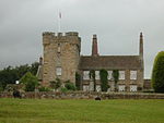
Bingfield is a village and former civil parish, now in the parish of Whittington, in Northumberland, in England. It is situated to the north of Corbridge, off the A68 road and includes some properties situated on the A68 (Dere Street). In 1951 the parish had a population of 76.
Excerpt from the Wikipedia article Bingfield (License: CC BY-SA 3.0, Authors, Images).Bingfield
Zum Frankenbrunnen,
Geographical coordinates (GPS) Address Nearby Places Show on map
Geographical coordinates (GPS)
| Latitude | Longitude |
|---|---|
| N 55.047 ° | E -2.041 ° |
Address
Zum Frankenbrunnen 1
66450 , Frankenholz (Frankenholz)
Saarland, Deutschland
Open on Google Maps


