Hunnum

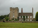
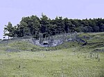
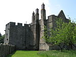
Hunnum (also known as Onnum, and with the modern name of Halton Chesters) was a Roman fort on Hadrian's Wall located north of the modern-day village of Halton, Northumberland in North East England. It was the fifth fort on Hadrian's Wall and is situated about 7.5 miles west of Vindobala fort, 5.9 miles east of Chesters fort and 2.5 miles north of the Stanegate fort of Coria (Corbridge). The site of the fort is bisected by the B6318 Military Road, which runs along the route of the wall at that point. The fort may also have guarded Dere Street which crosses the Roman Wall through the valley immediately to the west, but its distance from Dere Street and that Milecastle 22 was also displaced from Dere Street implies that this was not a priority and may have been expected to be disused north of the Wall after Hadrian's Wall was built.The Latinised Brittonic name “Onnum” may mean "Stream/Water", "Ash tree", or “Rock”; if it means "Stream", it may be a reference to the Fence Burn, where a stream touches the line of Hadrian's Wall, but if it means "Rock", it may refer to Down Hill situated to the east of it.
Excerpt from the Wikipedia article Hunnum (License: CC BY-SA 3.0, Authors, Images).Hunnum
Military Road,
Geographical coordinates (GPS) Address External links Nearby Places Show on map
Geographical coordinates (GPS)
| Latitude | Longitude |
|---|---|
| N 55.01 ° | E -2.006 ° |
Address
Haltonchesters Roman Fort (Onnum)
Military Road
NE45 5PZ , Whittington
England, United Kingdom
Open on Google Maps


