place

Harraseeket River

Freeport, MaineMaine river stubsRivers of Cumberland County, Maine
Harraseeket River South Freeport

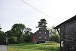
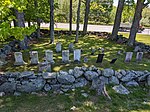
The Harraseeket River is a 3.2-mile-long (5.1 km) tidal river in the town of Freeport within the U.S. state of Maine. It forms a northern arm of Casco Bay.

Excerpt from the Wikipedia article Harraseeket River (License: CC BY-SA 3.0, Authors, Images).

Harraseeket River
Wolf Neck Road,

Geographical coordinates (GPS) Address Nearby Places
placeShow on map

Wikipedia: Harraseeket RiverContinue reading on Wikipedia

Geographical coordinates (GPS)

Latitude Longitude
N 43.8048 ° E -70.10033 °
placeShow on map

Address

Wolf Neck Road

Wolf Neck Road
04032
Maine, United States
mapOpen on Google Maps

Harraseeket River South Freeport
Share experience

Nearby Places

Casco Castle
Casco Castle

Casco Castle was a resort in South Freeport, Maine, United States. Built in 1903, it was intended to resemble a castle. Designed by William R. Miller and overlooking Casco Bay immediately to its east, it burned down in 1914. All that now remains is its 185-foot (56 m) tall stone tower, which is now on private property, inaccessible to the public. The tower can be viewed from Harraseeket Road, a few yards closer to the shoreline, or from Winslow Memorial Park, directly to the south across the Harraseeket River. The main part of the building was to the south, with the tower on its northern side, connected by a bridge.In 1903, Amos F. Gerald, of Fairfield, Maine, built the castle as a resort, with rooms for around one hundred guests, to encourage travel by trolleycars. It was his second attempt; the first, Merrymeeting Park, in Brunswick, Maine, was a failure. The grounds featured a hotel and restaurant, a picnic area, a baseball field, and a small zoo. The hotel burned in 1914, but its stone tower was spared. It stands today on private property. A popular place from which to view the tower is nearby Winslow Memorial Park.Trolleycars of the Portland & Brunswick Street Railway, of which Gerald was general manager, brought visitors from nearby Freeport. After alighting, they crossed 70 foot (21 m) above Spark Creek on a steel suspension bridge, then climbed steep steps to the hotel's entrance.Casco Castle Park was served by the Harpswell Steamboat Company, whose steamers stopped in South Freeport en route to and from Portland and Harpswell Center.The advent of the automobile contributed to the decline of trolley and steamer travel, and the resort closed in 1914 after an eleven-year run. It reopened the same year with new owners, but a fire broke out and destroyed the hotel. The stone tower survived.A photomechanical print of Casco Castle is in the archives of the Metropolitan Museum of Art in New York City.

Bustins Island
Bustins Island

Bustins Island is an island in inner Casco Bay, Maine, United States. It is part of the town of Freeport. Although physically located within Freeport, the Bustins Island Village Corporation is a self-governing entity. The island has approximately 117 summer cottages, with the earliest dating to the 18th century. The island's main road is Bustins Island Road, which loops around the island for about 1.5 miles (2.4 km). It is bisected by offshoot roads. Every island building stands beside one of the roads, allowing for easy access for trash removal.The island operates its own ferry, the Lilly B, which debarks from the South Freeport town wharf. Typically, the ferry operates from Memorial Day weekend through Columbus Day weekend. The ferry arrives at public dock at the southwestern tip of the island, but there is also a steamer dock on the island's western side. A public landing ramp is located at the northern end of the island.The island's interior is undeveloped because it is part of a resource protection area, which comprises parcels of land that are now protected against development. It, as with the rest of the island, is under constant threat of fire. There is no pressured water on the island, and since all of the cottages are over one hundred years old, they can be easily set alight accidentally. Six houses have burned to the ground over the years, the last in 2007. Due to this risk, no open fires or fire pits are permitted.The island is named for John Bustion, while its ferry, the Lilly B, is named for Lilly May Brewer (1906–1977), who, along with her husband Ralph (1900–1968), was the caretaker of Bustins during the 1950s and 1960s.

Wolfe's Neck Farm

Wolfe's Neck Center for Agriculture & the Environment (formerly Wolfe's Neck Farm) is a sustainable coastal farm in Freeport, Maine, United States. Located at 184 Burnett Road, the farm was established in 1959 by Philadelphia natives Eleanor Houston Smith (1910–1987) and Lawrence Smith (1902–1975).The farm was given to the University of Southern Maine by Eleanor Smith in 1985. Twelve years later, Wolfe's Neck Farm Foundation took over the management of the property.In addition to the farm, the property, which is situated on four miles (6.4 km) of Casco Bay coastline, also contains the main office building (located in the 1820s-built Little River House; renovated in 2017), a barn, a campground (Wolfe's Neck Oceanfront Camping at Recompence Shore Campground), a farm store and cafe, community gardens, hiking trails, the 1890-constructed Mallet Barn (at the end of Wolfe's Neck Road), the Banter House (restored in 2014; at the junction of Burnett and Wolfe's Neck Roads) and the Pote House and Barn (restored in 2017; on Wolfe's Neck Road). The Wishcamper Livestock Education Barn was built in 2017 where a barn, torn down in 2008, previously stood. An organic dairy barn, built at a cost of $1 million, opened in May 2019.Wolfe's Neck Farm was renamed Wolfe's Neck Center for Agriculture & the Environment in October 2017. In 2019, Wolfe's Neck Center received a donation of $25,000 from Kennebec Savings Bank "to support enhancements to its facilities."