place

Jack Elementary School

Defunct schools in Portland, MaineDemolished buildings and structures in MaineEducational institutions disestablished in 2001Maine school stubsMunjoy Hill
Portland Public Schools (Maine)

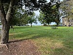
Jack Elementary School was a public elementary school located in the Munjoy Hill neighborhood of Portland, Maine. Jack Elementary was Portland's largest school until the time of its closure. The school made headlines when 100% of the teachers, administrators and other employees of the school reported symptoms related to mold poisoning from Stachybotrys chartarum. The mold can cause symptoms that are flu-like down up to pulmonary hemorrhage. The school was closed in 2001 and then later torn down as a result of the mold contamination. Students from the school were reassigned to three other schools within the city. A new school on, named East End Community School was opened in 2006. In its prime, the school was an impressive building. There were huge hallways with massive solid wood doors opening into large-size classrooms with high ceilings. The playground behind the school was built in the late 1980s by a cooperative effort involving contractors, school faculty and students, as well as members of the community who brought their own tools and donated their time. The new playground was said to be the largest and most modern playground in the city school system when it was finished. This school was originally built and known as Jack Junior High School for grade 7 and 8 students from the Munjoy Hill neighborhood, fed from Emerson School on Emerson St. and North School on Congress St (both now converted to housing).

Excerpt from the Wikipedia article Jack Elementary School (License: CC BY-SA 3.0, Authors).

Jack Elementary School
Eastern Prom Midslope Trail, Portland

Geographical coordinates (GPS) Address Nearby Places
placeShow on map

Wikipedia: Jack Elementary SchoolContinue reading on Wikipedia

Geographical coordinates (GPS)

Latitude Longitude
N 43.671111111111 ° E -70.253888888889 °
placeShow on map

Address

East End School

Eastern Prom Midslope Trail
04101 Portland
Maine, United States
mapOpen on Google Maps

Share experience

Nearby Places

East End Treatment Plant

The East End Treatment Plant is a water-treatment facility located in Portland, Maine, United States. At an average daily output of almost 20 million gallons, it is the largest treatment facility in the state. In operation since 1979, and run by Portland Water District, the plant sits at the opposite end of Tukey's Bridge from the former B&M Baked Beans factory. In addition to producing clean water, which flows into nearby Casco Bay, the facility also created hundreds of tons of treated biosolids. Around four million tons of septage from private septic systems in Maine's cities and towns are sent to the facility each year. The plant prevents around 9,000,000 pounds (4,100,000 kg) of pollution from entering Casco Bay on an annual basis.In 2018, the plant received a $12 million upgrade. In the summer of that year, over one million gallons of partially treated sewage was released into Casco Bay after a disinfection tank was not powered on after being cleaned. A second tank was overwhelmed by high rainfall. The plant was fined $16,800 by the Maine Department of Environmental Protection. The penalty was used to pay for restoration work at the city's Evergreen Cemetery.Another discharge occurred in July 2020, when nearly four million gallons of partially treated sewage was released into Casco Bay after a power failure at the plant. East End Beach, which was given a rebirth shortly after the plant came online in 1979, was temporarily closed.

Mayo Street Arts
Mayo Street Arts

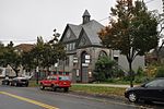
Mayo Street Arts is a community arts and performance venue in the East Bayside neighborhood of Portland, Maine. It was founded in 2010 by Blainor McGough after leasing the building which was formerly St. Ansgar Church. Mayo Street Arts' second executive director, Ian Bannon, succeeded McGough in May 2020 following McGough's resignation. Located next to Kennedy Park, a public housing development and close to many other public housing areas, Mayo Street Arts serves as a theater, concert venue, art gallery, and meeting space and offers affordable artist studios, rehearsal space, and a teaching platform for visual and performing artists of multicultural backgrounds. Programming is varied, but with a particular focus on puppetry, folk music, and dance. One of Mayo Street Arts' first programs was the Children's Puppet Workshop, which incorporated Portland's professional artist community and many children of immigrant families which focuses on puppetry and story-telling.Mayo Street Arts partners with a number of local organizations, including the East Bayside Neighborhood Association, Learning Works and the Maine College of Art. The venue, which has seating for 110 people, also hosts performances by local musicians who appreciate the building's natural acoustics.Mayo Street Arts first leased the building on Mayo Street from Roxanne Quimby's charitable foundation, which had owned the building since 2007. It subsequently purchased the building in 2013, after receiving a donation from the Brooks Family Foundation.Mayo Street Arts was supported the Virginia Somers Hodgkins Foundation in 2011, and in 2018 received a Stand for the Arts award for accessibility improvements.In 2021, Mayo Street Arts was awarded its first grant from the National Endowment for the Arts (NEA) in the amount of $10,000 to support the creation of a Traditional Arts Network in collaboration with Cultural Resources. The Traditional Arts Network will be a resource for traditional artists who wish to preserve and share artistic and cultural practices of important newcomer groups in New England. The pilot year of the project will focus on the Rwandan, Congolese, Burundi, Somali, and Somali Bantu communities of Portland and Lewiston. This network will pool resources to offer support in marketing, grant-writing, documentation, video production, and access to rehearsal space.As of June 2022, Mayo Street Arts is wheelchair accessible.

East Bayside
East Bayside

East Bayside is a neighborhood in Portland, Maine. It is bordered by Franklin Street on the west, Washington Avenue on the east, to the north by Marginal Way, and the south by Congress Street. It is bordered by the neighborhoods of Bayside, the Old Port and Munjoy Hill. It is often confused with the Bayside neighborhood, which is on the opposite side of Franklin Street. East Bayside was first developed a street network in the early 19th century. By the 1820s the area was Portland's second seaport via the Back Cove’s ship channel. Much of the debris from the great Portland fire of 1866 was deposited into Back Cove, significantly increasing the size of Bayside and East Bayside. Maps produced around 1900 show an extension of the shoreline out to Marginal Way and beyond. The shoreline would not change again until the construction of the Interstate in 1974. In the 19th century the Bayside and East Bayside neighborhoods were a mix of residential, commercial, and industrial uses. Manufacturing, including a foundry and a rope factory, was served, first by ship traffic on Back Cove and later, when the Cove channel was abandoned, by rail. The original rail line roughly forms the demarcation between the industrial zone, now located to the north of Fox Street, and the residential uses to the south. In the early 1950s the newly created Slum Clearance and Redevelopment Authority highlighted East Bayside as a target neighborhood. In 1958 the Authority demolished the Little Italy neighborhood, a portion of which was in what we now call East Bayside, razing 92 dwellings and 27 small businesses. Another 54 dwelling units were razed for the Bayside Park urban renewal project, an area that now includes Fox Field and Kennedy Park public housing. The first phase of the Kennedy Park was built in 1965. Several streets were truncated in an attempt to limit access to outside traffic. The razing of Franklin Street began in 1967; 100 structures were demolished and an unknown number of families relocated or were displaced. The neighborhood was cut off from Bayside and the Old Port when the four-lane, limited access Franklin Arterial was built to allow people who lived outside of Portland to enter and exit the city rapidly. Many existing streets, such as Oxford Street, were truncated by the creation of the road, creating a confusing street grid where roads have the same name but don't connect. The neighborhood has historically provided a home for recent immigrants with large population of Irish, Scandinavians, and Italians in the late 19th century. During the early 20th century over 250 Armenian families settled in the neighborhood. More recently East Bayside has become home to new immigrants including Cambodians, Vietnamese, and, most recently, Sudanese, Somalis, and Iraqis.The neighborhood is also prone to severe flooding events during King Tides, rainstorms, and during the spring snow melt. This is likely due to the fact that some of the area sits on artificial land. Climate change has proven to be a problem for Bayside, with some sources showing that Back Cove may expand back to its original pre-19-century levels by 2100, making most of Bayside uninhabitable once again.According to the 2010 census, Census Tract 5 is the most diverse section of Portland, Maine. It is 60% White, 21% Black, 6% Hispanic, 8% Asian, 1% Native American, and 4% Multiracial.In 2011, Mayo Street Arts, a community arts venue, opened on Mayo Street, adjacent to Kennedy Park in the previously unoccupied St. Angsar Church.