India Street is a downtown street and neighborhood in Portland, Maine, United States. Situated near the western foot of Munjoy Hill, it runs for around 0.28 miles (0.45 km), from Congress Street in the northwest to Commercial Street and Thames Street in the southeast. It was the city's first street, and the location of the first settlement of European immigrants to the city (then called Falmouth) in the 17th century. There are thirty handmade bricks in the sidewalk commemorating the neighborhood's notable events. In 1680, when Thomas Danforth was Deputy Governor of the Massachusetts Bay Colony, the street was known as Broad Street. After the incorporation of the Town of Falmouth in 1718, the street was known as High King Street.
The neighborhood has been home to Europeans (1600s), African Americans (1700s), and Irish, Jews, Scots, Russians, Swiss and Portuguese (late 1800s).
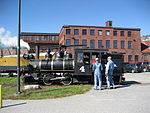
One of Portland's four stations for the Portland and Forest Avenue Railroad Company was located at the foot of India Street, at its intersection with Commercial Street and Thames Street. Known as the Grand Trunk Station, it was built in 1903, when it was one of the two stations in the city, the other being the Union Station, on Saint John Street, which was demolished in 1961. Grand Trunk Station was demolished five years later, having stood for sixty-three years; its clock tower had been taken down in 1948. Its office building remains intact, at the corner of India Street and Thames Street, in use as a Gorham Savings Bank as of 2024.
Clay Cove, the home of early shipyards, stood at the foot of India Street in the 19th century. Atlantic Railroad Wharf formerly stood at the foot of India Street. It was demolished in the early 20th century, when Maine State Pier was constructed.
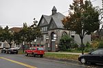
After Portland's great fire of 1866, a fire house was built at 97 India Street.
In the early 1950s, the newly created Slum Clearance and Redevelopment Authority highlighted Bayside and East Bayside as target neighborhoods due to its high number of immigrants and the decaying buildings caused by redlining. Residents of these neighborhoods resisted the discriminatory campaign. In 1958, the Authority demolished the Little Italy neighborhood, which spanned from the India Street neighborhood to the East Bayside neighborhood, razing 92 dwellings and 27 small businesses. Another 54 dwelling units were razed for the Bayside Park urban renewal project, an area that now includes Fox Field and Kennedy Park public housing. The first phase of the Kennedy Park was built in 1965. Several streets were truncated in an attempt to limit access to outside traffic. The razing of Franklin Street began in 1967; 130 homes and businesses were demolished and an unknown number of families relocated or were displaced.
The India Street Historic District was designated by Portland City Council in 2015 after a unanimous (8–0) vote. As a result, maximum building heights of 50 feet (15 m) were introduced on India Street, as well as parts of Commercial Street, Middle Street and Congress Street. The following year, the Historic Preservation and Planning Board recommended that the boundaries of the India Street Historic District be expanded to include 96 and 100 Federal Street as contributing buildings. Portland City Council passed the motion in June.
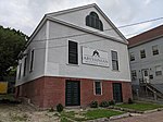
Etz Chaim Synagogue sits across from the head of India Street, at 267 Congress Street.


