place

Los Molinos, Madrid

Madrid geography stubsMunicipalities in the Community of Madrid
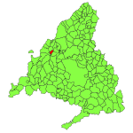
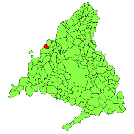
Los Molinos (Madrid) mapa

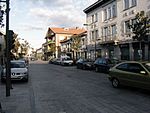
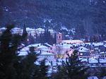
Los Molinos is a municipality of the Community of Madrid, Spain. There is a wine, also called Los Molinos, which originates from the same place.

Excerpt from the Wikipedia article Los Molinos, Madrid (License: CC BY-SA 3.0, Authors, Images).

Los Molinos, Madrid
Travesía Calvario,

Geographical coordinates (GPS) Address Nearby Places
placeShow on map

Wikipedia: Los Molinos, MadridContinue reading on Wikipedia

Geographical coordinates (GPS)

Latitude Longitude
N 40.711111111111 ° E -4.0744444444444 °
placeShow on map

Address

Travesía Calvario
28460 , Matarrubia
Community of Madrid, Spain
mapOpen on Google Maps

Los Molinos (Madrid) mapa
Share experience

Nearby Places

Los Negrales
Los Negrales

Los Negrales is a residential zone in the municipal area of Collado Villalba, Alpedrete, San Lorenzo de El Escorial, Guadarrama and Galapagar (municipalities of the northwest of the Community of Madrid, Spain), consisting mostly of detached houses. Although it was divided in three administrative zones, Los Negrales is a contiguous residential area. This residential zone was built gradually. The oldest houses date to the first half of the 20th century, and building has continued until contemporary times. A significant part of the houses are second residences of their owners, therefore, in summer and in holidays the population doubles. Los Negrales is situated near the Sierra de Guadarrama and near the centre of Collado Villalba, which makes it a favorable place to spend the holidays. The short distance to Collado Villalba facilitates shopping and leisure. Los Negrales has considerable public facilities (parish church, public schools, a sports center, a municipal park and a pharmacy, among others). This area is divided in two parts: Los Negrales (neighbourhood) and the Colony Fuentellana (where the station of Los Negrales is located), and both zones are divided by the avenue of Reina Victoria (ancient N-SAW or road of La Coruña). Los Negrales has public bus service and has a train station of the line C-8b of Cercanías Madrid called Los Negrales, situated in the municipality of Alpedrete. The motorway Autopista del Noroeste passes north of Los Negrales, as does the highway Carretera Nacional N-VI. Another main road, M-510, runs along the western side of Los Negrales, and the junction of the three roads is located in the north-west of the area. The name of Los Negrales is based upon a nearby forest of black pine (pino negral in Spanish). Its patron saint is Our Lady of Mount Carmel, on whose feast day (16 July) a procession is held. Los Negrales is home to an Augustine college, a Theresian institution, a community of the Claretians, and a hall of Jehovah's Witnesses.
Valley of the Fallen

The Valley of Cuelgamuros (Spanish: Valle de Cuelgamuros), formerly known as Valley of the Fallen (Spanish: Valle de los Caídos), is a monument in the Sierra de Guadarrama, near Madrid. The valley contains a Catholic basilica and a monumental memorial in the municipality of San Lorenzo de El Escorial. Dictator Francisco Franco ordered the construction of the monumental site in 1940; it was built from 1940 to 1958, and opened in 1959. Franco said that the monument was intended as a "national act of atonement" and reconciliation.The site served as Franco's burial place from his death in November 1975—although it was not originally intended that he be buried there—until his exhumation on 24 October 2019 following a long and controversial legal process, due to moves to remove all public veneration of his dictatorship. The monument, considered a landmark of 20th-century Spanish architecture, was designed by Pedro Muguruza and Diego Méndez on a scale to equal, according to Franco, "the grandeur of the monuments of old, which defy time and memory." Together with the Universidad Laboral de Gijón, it is the most prominent example of the original Spanish Neo-Herrerian style, which was intended to form part of a revival of Juan de Herrera's architecture, exemplified by the nearby royal residence El Escorial. This uniquely Spanish architecture was widely used in public buildings of post-war Spain and is rooted in international fascist classicism as exemplified by Albert Speer or Mussolini's Esposizione Universale Roma. The monument precinct covers over 13.6 square kilometres (3,360 acres) of Mediterranean woodlands and granite boulders on the Sierra de Guadarrama hills, more than 900 metres (3,000 ft) above sea level and includes a basilica, a Benedictine abbey, a guest house, the Valley, and the Juanelos—four cylindrical monoliths dating from the 16th century. The most prominent feature of the monument is the towering 150-metre-high (500 ft) Christian cross, the tallest such cross in the world, erected over a granite outcrop 150 metres over the basilica esplanade and visible from over 30 kilometres (20 mi) away. Work started in 1940 and took over eighteen years to complete, with the monument being officially inaugurated on 1 April 1959. According to the official ledger, the cost of the construction totalled 1,159 million pesetas, funded through national lottery draws and donations. Some of the labourers were prisoners who traded their labour for a reduction in time served. The complex is owned and operated by the Patrimonio Nacional, the Spanish governmental heritage agency, and ranked as the third most visited monument of the Patrimonio Nacional in 2009. The Spanish social democrat government closed the complex to visitors at the end of 2009, citing safety reasons connected to restoration on the façade. The decision was controversial, as the closure was attributed by some people to the Historical Memory Law enacted during José Luis Rodríguez Zapatero's premiership, and there were claims that the Benedictine community was being persecuted. The works include the Pietà sculpture prominently featured at the entrance of the crypt, using hammers and heavy machinery.

San Lorenzo de El Escorial

San Lorenzo de El Escorial, also known as El Escorial de Arriba, is a town and municipality in the Community of Madrid, Spain, located to the northwest of the region in the southeastern side of the Sierra de Guadarrama, at the foot of Mount Abantos and Las Machotas, 47 kilometres (29 mi) from Madrid. It is head of the eponymous judicial party. The settlement is popularly called El Escorial de Arriba, to differentiate it from the neighbouring village of El Escorial, also known as El Escorial de Abajo. The Monastery of El Escorial is the most prominent building in the town and is one of the main Spanish Renaissance monuments. Especially remarkable is the Royal Library, inside the Monastery. The monastery and its historic surroundings were declared a World Heritage Site UNESCO on November 2, 1984, under the name of "El Escorial, monastery and site". The site also enjoys protection on Spain's heritage register; since June 21, 2006, it has been protected by the Community of Madrid as a Property of Cultural Interest. San Lorenzo de El Escorial is located on the southern slopes of the Mount Abantos (elevation 1753 m). The average altitude of the municipality is 1,032 metres (3,386 ft), and most of the urban area is above 1,000 metres (3,300 ft). The hamlet initially sprang up around Monastery of El Escorial, gradually extending up the mountain. In the 20th and 21st centuries, the town underwent a strong urban expansion, particularly towards the southeastern side of Mount Abantos.