Rancho San Mateo
1846 establishments in Alta California1846 in Alta CaliforniaBurlingame, CaliforniaCalifornia ranchosRanchos of San Mateo County, California ... and 1 more
San Mateo, California
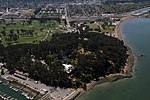
Rancho San Mateo was a 6,439-acre (26.06 km2) Mexican land grant on the San Francisco Peninsula, in present day San Mateo County, California. It was given in 1846 by Governor Pio Pico to Cayetano Arenas.Rancho San Mateo extended from the foothills of the Santa Cruz Mountains to San Francisco Bay. It included Coyote Point, about one-half the present city of San Mateo, all of Burlingame and most of Hillsborough.
Excerpt from the Wikipedia article Rancho San Mateo (License: CC BY-SA 3.0, Authors).Rancho San Mateo
North Humboldt Street, San Mateo
Geographical coordinates (GPS) Address Nearby Places Show on map
Geographical coordinates (GPS)
| Latitude | Longitude |
|---|---|
| N 37.58 ° | E -122.33 ° |
Address
Clubhouse
North Humboldt Street
94401 San Mateo
California, United States
Open on Google Maps


