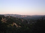
Rancho Acalanes
1834 establishments in Alta CaliforniaCalifornia ranchosLafayette, CaliforniaOrinda, CaliforniaRanchos of Contra Costa County, California
Rancho Acalanes was a 3,329-acre (13.47 km2) Mexican land grant in present-day Contra Costa County, California. It was given in 1834 by Governor José Figueroa to Candelario Valencia. The name Acalanes seems to have come from Ahala-n, the name of a Costanoan native village in the area, or from the Saklan tribe, sometimes known as the Sacalanes The rancho included present-day Lafayette and northern Orinda.
Excerpt from the Wikipedia article Rancho Acalanes (License: CC BY-SA 3.0, Authors).Rancho Acalanes
Garden Lane,
Geographical coordinates (GPS) Address Nearby Places Show on map
Geographical coordinates (GPS)
| Latitude | Longitude |
|---|---|
| N 37.9 ° | E -122.12 ° |
Address
Garden Lane 1191
94549
California, United States
Open on Google Maps


