place

Palisades Charter High School

1961 establishments in CaliforniaAll pages needing cleanupCharter high schools in CaliforniaEducational institutions established in 1961High schools in Los Angeles
Los Angeles Unified School District schoolsPacific Palisades, Los AngelesSunset Boulevard (Los Angeles)Use mdy dates from April 2013Wikipedia pending changes protected pages

Palisades Charter High School (usually colloquially known as Pali or Pali High and abbreviated as PCHS) is an independent charter secondary school in Los Angeles, United States. The high school serves the neighborhoods of Pacific Palisades, Palisades Highlands, Kenter Canyon, and portions of Brentwood (including Brentwood Circle). Residents in Topanga, an unincorporated section of Los Angeles County, may attend Palisades or William Howard Taft Charter High School.The school serves grades 9 through 12. Formerly directly administered by the Los Angeles Unified School District, the school is now an independent charter school. Its current enrollment numbers 2,903 students. Many students travel long distances to attend Palisades Charter High, which is one of the most highly ranked public high schools in the Los Angeles area. In 2005, Palisades was recognized as a California Distinguished School. In 2015, Palisades was named one of America's Best High Schools by Newsweek and U.S. News & World Report.Paul Revere Charter Middle School students are allowed to attend as a feeder school.

Excerpt from the Wikipedia article Palisades Charter High School (License: CC BY-SA 3.0, Authors).

Palisades Charter High School
Bowdoin Street, Los Angeles Pacific Palisades

Geographical coordinates (GPS) Address External links Nearby Places
placeShow on map

Wikipedia: Palisades Charter High SchoolContinue reading on Wikipedia

Geographical coordinates (GPS)

Latitude Longitude
N 34.04772 ° E -118.530918 °
placeShow on map

Address

Palisades Charter High School

Bowdoin Street
90402 Los Angeles, Pacific Palisades
California, United States
mapOpen on Google Maps

linkWikiData (Q7127596)
linkOpenStreetMap (22988371)

Share experience

Nearby Places

Pacific Palisades, Los Angeles

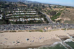
Pacific Palisades is a neighborhood in the Westside region of Los Angeles, California, situated about 20 miles (32 km) west of Downtown Los Angeles.Pacific Palisades was formally founded in 1921 by a Methodist organization, and in the years that followed became a refuge for Jewish artists and intellectuals fleeing the Holocaust. The Palisades would later be sought after by celebrities and other high-profile individuals seeking privacy. It is known for its seclusion and for being a close-knit community with a small-town feel, as well as its Mediterranean climate, hilly topography, natural environment, and abundance of parkland and hiking trails, 3-mile (4.8 km) strip of coastline, and for being home to a number of architecturally significant homes.Pacific Palisades has historically been home to many Hollywood celebrities. Due to its secluded location compared to other affluent areas such as Beverly Hills, notable residents are afforded more privacy and paparazzi are uncommon. People in the entertainment industry and other affluent residents also live throughout the Palisades, although some residents are middle class. As of 2018, the community's population was 28,881. Pacific Palisades is a largely residential community and does not attract many tourists other than day visitors to Gladstones Malibu, the local beaches, the Getty Villa or the Self-Realization Fellowship Lake Shrine. Nicknamed "the Palisades" and “Pali” by surfers and locals, the three-mile length of the Palisades coast spans from after Sorrento Beach in Santa Monica to the south ending at Sunset Point Beach with Malibu to the north. Beaches along the Pacific Palisades coast include: Will Rogers State Beach, Sunset Point Beach, and one of the few gay beaches in Los Angeles, Ginger Rogers Beach. The many parks within the Santa Monica Mountains National Recreation Area lie along the ridges above the community along with local parks that include Will Rogers State Historic Park. The Palisades is bounded by Brentwood to the east, Malibu to the west, Santa Monica to the southeast, the Santa Monica Bay to the southwest, Topanga and the Santa Monica Mountains to the north.

Old Santa Monica Forestry Station

The Old Santa Monica Forestry Station is the nation's first experimental forestry station, built in 1887. The Old Santa Monica Forestry Station was designated a California Historic Landmark (No.840) on March 20, 1970. Old Santa Monica Forestry Station is located at Rustic Canyon in Los Angeles in the Santa Monica Mountains of Southern California in Los Angeles County. The site is south of what is now called Santa Monica Mountains National Recreation Area. In 1971 the state placed a marker near the entrance of the Rustic Canyon Recreation Center at the NW corner of Latimer and Hilltree Roads, at 601 Latimer Road, Los Angeles, CA 90402. This location is in what is now called Pacific Palisades. The hills and canyons around the Santa Monica Canyon were a land boom in the late 1880s. Abbot Kinney (1850-1920), from New Jersey, was a land developer and a conservationist. Kinney is best known for his "Venice of America" development in Los Angeles. Kinney was appointed to a three-year position as chairman of the California Board of Forestry. Kinney established the nation's first forestry station in Rustic Canyon on 6 acres (24,000 m2) of land donated by Santa Monica co-founder John P. Jones (also a U.S. Senator from Nevada), and Arcadia Bandini de Stearns Baker. One of the station's projects was a study of the newly introduced eucalyptus trees. Located one mile inland from Pacific Ocean's Santa Monica Bay, Rustic Canyon was a good place for the new experimental forestry station. The station tested exotic trees to see if they were good for planting in California. The station started plantations, management studies, and grew plants for scientific and conservation studies. In 1893 the station turned over operation to the University of California, which ran the station till 1923. Abbot Kinney published two books from the work done at the Old Santa Monica Forestry Station: a 1895 book tilted Eucalyptus, B.R. Baumgardt & Co., ISBN 1-4086-6309-0, 334 pages, 2008) and in 1900 the book titled Forest and Water, The Post publishing Company. The eucalyptus groves in Rustic Canyon, the site of the Old Santa Monica Forestry Station, still stand today. A state plaque was dedicated on August 18, 1971 next to the eucalyptus groves.