place

Church of St Peter, Yeovilton

14th-century church buildings in EnglandChurch of England church buildings in South SomersetGrade I listed buildings in South SomersetGrade I listed churches in Somerset
Podimore church
Podimore church

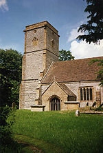
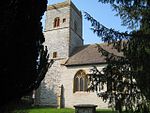
The Church of St Peter at Podimore in the parish of Yeovilton, Somerset, England, dates from the early 14th century and has been designated as a Grade I listed building.The church is built on the site of a previous building which is recorded in the Domesday Book from which time it was under the control of Glastonbury Abbey, who held the advowson until the dissolution of the monasteries.The church has a chancel, nave and west tower. The tower is in four stages, the lowest is square and the others are octagonal. It contains a single bell which was cast in 1633. Survey work was undertaken on the tower in 2012 for future renovation. The chancel arch is probably the oldest part of the building.The interior includes altar rails dating from the late 17th century and fragments of glass in the east window which date from the 1490s. There are also traces of wall paintings.The Anglican parish of Yeovilton with Podimore is part of the benefice of Ilchester with Northover and Limington within the archdeaconry of Wells.

Excerpt from the Wikipedia article Church of St Peter, Yeovilton (License: CC BY-SA 3.0, Authors, Images).

Church of St Peter, Yeovilton
Church Street,

Geographical coordinates (GPS) Address Nearby Places
placeShow on map

Wikipedia: Church of St Peter, YeoviltonContinue reading on Wikipedia

Geographical coordinates (GPS)

Latitude Longitude
N 51.021666666667 ° E -2.6491666666667 °
placeShow on map

Address

Church Street
BA22 8JH , Yeovilton and District
England, United Kingdom
mapOpen on Google Maps

Podimore church
Podimore church
Share experience

Nearby Places

Lytes Cary
Lytes Cary

Lytes Cary is a manor house with associated chapel and gardens near Charlton Mackrell and Somerton in Somerset, England. The property, owned by the National Trust, has parts dating to the 14th century, with other sections dating to the 15th, 16th, 18th, and 20th centuries. "Yet all parts blend to perfection with one another and with the gentle sunny landscape that surrounds them," comments Nikolaus Pevsner. The House is listed as Grade I by English Heritage. The chapel predates the existing house, having been built around 1343, and functioned as a chantry chapel, where masses could be said for the souls of the family, both living and dead. The great hall was added in the 15th century and the Oriel Room in the 16th. Various renovations were undertaken during the 16th and 17th centuries after which the house fell into disrepair with the north range being demolished by the early 19th century. In 1907 Sir Walter Jenner of the Jenner baronets bought the house and restored it in a period style, furnishing it with fine 17th century and 18th century oak furniture, antique tapestries and fabrics modelled after medieval textiles, along with historic and period paintings. On his death in 1948 he left the house to the National Trust. The gardens are listed as Grade II on the Register of Historic Parks and Gardens of special historic interest in England. The original 17th-century gardens have disappeared. However, the Jenners laid them out in an Arts and Crafts style with a series of 'rooms', which are separated from each other by high, neatly clipped box and yew hedges. These are complemented by ponds and walks in and between each of the 'rooms'.

River Cam (Somerset)

The River Cam is a tributary of the River Yeo in the south of Somerset, England. The Cam rises east of Yarlington (51°00′06″N 2°38′11″W). It flows south west past North Cadbury, Sparkford, Queen Camel and West Camel, and joins the Yeo near Yeovilton (51°00′06″N 2°38′11″W).Other tributaries include the stream (designated Main River) through Blackford and Compton Pauncefoot and benefited from works in the 1980s to the riverbanks in Blackford to help keep the water moving. Flooding in Blackford is rarer than previously, as a result. This tributary stream has its headwaters in the hills around Blackford and Compton Pauncefoot together with a number of springs. The main waters come from three primary sources: Maperton, Quarry Hill and Sigwells Hill. The first two combine in Blackford around the Crossroads/Hollow and further springs contribute at several points all the way through both villages. The river then travels under the A303 to join the Yarlington headwaters. The Cam flows onto the Royal Naval Station at Yeovilton where it joins the Yeo, which in turn flows west to the south of Yeovilton and through the town of Ilchester. The river course continues to the west and at Langport becomes the River Parrett. In 2009 the river burst its banks at West Camel following flash flooding.The dates the river got to top of the banks in Blackford since 2000 were: 9th May 2023 24th March 2023 4th January 2014 9th February 2009 13th December 2008 Previous floods: 2000 May 1979 - major flooding of church 9th May 2023 flooding was caused by 2 thunderstorms converging and becoming trapped in the vicinity of North Cadbury and creating major flooding from River Cam (& tributaries) of Queen Camel, West Camel, North Cadbury and other villages making the national news. Somerset County Council has started a Section 19 investigation under the Flood & Water Management Act 2010 by holding a series of meetings in June 2023 to gather information. A report will be issued in due course. The Environment Agency has a monitoring station that gives a clear idea of how the water levels in the River Cam at Weston Bampfylde [1] rises and falls: 0.60m is considered normal Record High Levels: 2.09m 13.12.08 2.85m 9.5.23 The data shows the river exceeded 1m on 28 occasions between 1998 and 2023: 1m - 1.29m 14 occasions 1.3m - 1.49m 8 occasions 1.5m or more 6 occasions Total 28 1998 - Oct 2002 = 0 Nov 2002 - Dec 2007 = 3 Jan 2008 - Dec 2012 = 10 Jan 2013 - Dec 2018 = 10 Jan 2019 - Jul 2023 = 5 Total 28 Some years had no events and the maximum in one year was 5 in 2008.