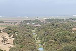
East Garrison, California

East Garrison is a planned community in an unincorporated area in Monterey County, California. It is located on Reservation Road (County Route G17) east of Marina and west of the Salinas River on the former Fort Ord. The community has 929 taxed parcels (779 single family homes and 150 single family attached properties). The community contains many parks including dog parks, the 5-acre Lincoln Park with sports field as well as West Camp Park, McArthur Park, Arts Park which are approximately one acre each. East Garrison is part of Monterey County's Fourth District and, as of January 5, 2021, is represented by Supervisor Wendy Root Askew.Permit PLN030204 was approved by the County of Monterey Board of Supervisors in 2005. This allowed development of the East Garrison project, a mixed-use residential development consisting of up to 1,470 dwelling units. The project is also subject to a Disposition and Development Agreement (DDA) approved by the former Redevelopment Agency for the County of Monterey (now Successor Agency) which requires Agency financial assistance to pay for a portion of certain aspects, including public facilities, affordable housing and historic preservation and renovation. As of January 2023, East Garrison has developed into a community consisting of: 994 homes with supporting infrastructure and public improvements, including: 808 market-rate units 65 affordable apartments (very low and low-income) Manzanita Place, an affordable-housing apartments managed by MidPen Housing was built in Phase 1. 51 moderate-income units 70 work force II units Fire station 37 acres of community, neighborhood and dog parks, open space and trails. An additional 65 affordable apartments are under construction and anticipated to be completed spring of 2023.Remaining housing and public facilities to be built (not-yet-under construction) per the development approvals at East Garrison include: 341 housing units 172 market rate 70 work force II 33 moderate-income 66 very low and low-income apartments Community Housing Improvement Systems and Planning Association (CHISPA) will soon construct 66 units in the Phase 3 area plus 70 optional ADUs Library with Sheriff sub-station A minimum 34,000 sf Town Center (of which 4,000 sf is the Library/Sheriff sub-station) The 1-acre Town Center Park Rehabilitation and reuse of 23 historic buildings."Planned, but not yet started, is conversion of historic buildings into 55,000 sq. ft of artist studios.On January 24, 2023, the builder, Century Communities, requested adjustments to the existing approvals: Re-locating the 66 Artspace rental affordable live/work units to an existing parcel on the south side of the Town Center Park and replacing the two Artspace building parcels flanking the Arts Park with compact single-family homes. Create a fully integrated mixed-use commercial/residential 3-4 story building consisting of the 66 Artspace affordable units above 30,000 square feet of flexible commercial space on the ground floor. Infill of the existing north parcel adjacent to the Town Center Park with Rowhouses, with the units facing the park having “flex workspace” and shopfront facades. Infill of the High-Density Condominium site with compact high density 2-3 story Single Family homes.
Excerpt from the Wikipedia article East Garrison, California (License: CC BY-SA 3.0, Authors, Images).East Garrison, California
Ord Avenue,
Geographical coordinates (GPS) Address Nearby Places Show on map
Geographical coordinates (GPS)
| Latitude | Longitude |
|---|---|
| N 36.653055555556 ° | E -121.7325 ° |
Address
Ord Avenue
Ord Avenue
California, United States
Open on Google Maps


