place

Jerusalem–Malha railway station

Railway stations in JerusalemRailway stations opened in 2005
Jerusalem–Malha railway station, 2019 (01)

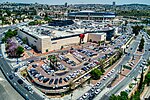
Jerusalem–Malha railway station (Hebrew: תחנת הרכבת ירושלים – מלחה, Tahanat HaRakevet Yerushalayim–Malha; Arabic: محطة أورشليم – المالحة) was one of two Israel Railways termini in Jerusalem, the other being Jerusalem–Yitzhak Navon railway station. The station is located in the southern neighborhood of Malha, across from the Jerusalem Shopping Mall, Pais Arena and Teddy Stadium. As it is much less centrally located than Navon station, and the historic Jaffa–Jerusalem railway provides a much slower journey to the Tel Aviv area than the modern Tel Aviv–Jerusalem railway, ridership is very low. 115,118 passengers boarded or disembarked at the station in 2019, ahead of only the adjacent Biblical Zoo railway station and Dimona railway station. Service to the station has been suspended entirely since March 2020 due to poor usage combined with the economic impacts of the COVID-19 pandemic, and it is unclear if or when it will resume.

Excerpt from the Wikipedia article Jerusalem–Malha railway station (License: CC BY-SA 3.0, Authors, Images).

Jerusalem–Malha railway station
Yitzhak Modai, Jerusalem Malha

Geographical coordinates (GPS) Address Nearby Places
placeShow on map

Wikipedia: Jerusalem–Malha railway stationContinue reading on Wikipedia

Geographical coordinates (GPS)

Latitude Longitude
N 31.748083333333 ° E 35.187533333333 °
placeShow on map

Address

ת. רכבת מלחה

Yitzhak Modai
9695102 Jerusalem, Malha
Jerusalem District, Israel
mapOpen on Google Maps

Jerusalem–Malha railway station, 2019 (01)
Share experience

Nearby Places

Sharafat, East Jerusalem

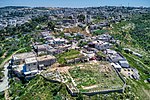
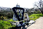
Sharafat (Arabic: شرفات) is a Palestinian Arab neighborhood of East Jerusalem, located within approximately 5 km to the south west of the Old City of Jerusalem. It is situated close to the Palestinian town of Beit Safafa and near the Israeli settlement of Gilo in the southern portion of East Jerusalem.Sharafat is later mentioned in chronicles from the 13th and 15th centuries, Ottoman tax records from the 16th century, and the travel writings and ethnographies of European and American visitors to Palestine in the 19th and 20th centuries. During the period of Mamluk rule (c. 13th - early 16th centuries), Sharafat was home to the Badriyya a renowned family of awliya (Muslim saints) to whom the village was dedicated as a waqf (Islamic trust) by the viceroy of Damascus in the 14th century, and whose family tombs continue to be venerated to this day. After the 1948 Palestine War, Sharafat lay in the area to the east of the Green Line that was ruled by Jordan until 1967. Following the occupation West Bank, including East Jerusalem by Israel in the 1967 Six-Day War, Israel included it in its expanded Jerusalem District. In the 1970s, the Israeli government expropriated land from the village to build the settlement of Gilo, whose subsequent expansion saw the destruction of homes, vineyards and orchards in Sharafat. The Palestinian Authority (PA), established pursuant to 1993 Oslo Accords, considers Sharafat a part of its Jerusalem Governorate. In 2002, the population was made up of 978 Palestinians.