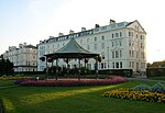
Hunmanby
Borough of ScarboroughCivil parishes in North YorkshireHunmanbyOpenDomesdayUse British English from June 2016 ... and 1 more
Villages in North Yorkshire

Hunmanby is a large village and civil parish in North Yorkshire, England. It was part of the East Riding of Yorkshire until 1974. From 1974 to 2023 it was in the Scarborough district of the shire county of North Yorkshire. In 2023 the district was abolished and North Yorkshire became a unitary authority. It is on the edge of the Yorkshire Wolds, 3 miles (4.8 km) south-west of Filey, 9 miles (14 km) south of Scarborough and 9 miles (14 km) north of Bridlington. The village is on the Centenary Way. At the 2011 census, Hunmanby had a population of 3,132.Hunmanby railway station is on the Yorkshire Coast Line between Hull and Scarborough.
Excerpt from the Wikipedia article Hunmanby (License: CC BY-SA 3.0, Authors, Images).Hunmanby
Stonegate,
Geographical coordinates (GPS) Address Nearby Places Show on map
Geographical coordinates (GPS)
| Latitude | Longitude |
|---|---|
| N 54.181786 ° | E -0.317532 ° |
Address
Stonegate
Stonegate
YO14 0LJ , Hunmanby
England, United Kingdom
Open on Google Maps


