place

Hilarita, California

Marin County, California geography stubsNeighborhoods in Marin County, California

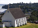
Hilarita is a former unincorporated community now incorporated in Belvedere and Tiburon in Marin County, California. It lies at an elevation of 13 feet (4 m).

Excerpt from the Wikipedia article Hilarita, California (License: CC BY-SA 3.0, Authors).

Hilarita, California
Tiburon Boulevard,

Geographical coordinates (GPS) Address Nearby Places
placeShow on map

Wikipedia: Hilarita, CaliforniaContinue reading on Wikipedia

Geographical coordinates (GPS)

Latitude Longitude
N 37.884166666667 ° E -122.47194444444 °
placeShow on map

Address

Tiburon Boulevard & San Rafael Avenue

Tiburon Boulevard
94920
California, United States
mapOpen on Google Maps

Share experience

Nearby Places

Richardson Bay
Richardson Bay

Richardson Bay (originally Richardson's Bay) is a shallow, ecologically rich arm of San Francisco Bay, managed under a Joint Powers Agency of four northern California cities. The 911-acre (369 ha) Richardson Bay Sanctuary was acquired in the early 1960s by the National Audubon Society. The bay was named for William A. Richardson, early 19th century sea captain and builder in San Francisco. It contains both Strawberry Spit and Aramburu Island. In spite of its urbanized periphery, Richardson Bay supports extensive eelgrass areas and sizable undisturbed intertidal habitats. It is a feeding and resting area for a panoply of estuarine and pelagic birds, while its associated marshes and littoral zones support a variety of animal and plant life. Richardson Bay has been designated as an Important Bird Area (IBA), based upon its large number of annual bird visitors and residents, its sightings of California clapper rail and its strategic location on the Pacific Flyway. The bay's waters are subject to a "no discharge" rule to protect the elaborate and fragile ecosystems present, including a complex fishery, diverse mollusk populations and even marine mammals such as the harbor seal. Owing to its lack of depth and complicated channel structure, Richardson Bay is limited in boating uses to kayaking and small sailing craft. There are extensive hiking and bicycling paths at the bay perimeter, especially in the shore areas of Mill Valley and the town of Tiburon.

Tiburon, California
Tiburon, California

Tiburon (; Spanish: Tiburón, [tiβuˈɾon]) is an incorporated town in Marin County, California. It is located on the Tiburon Peninsula, which reaches south into the San Francisco Bay. It shares a ZIP code (94920) with the smaller incorporated city of Belvedere (formerly a separate island), which occupies the southwest part of the peninsula and is contiguous with Tiburon. Tiburon is bordered by Corte Madera to the north and Mill Valley to the west, but is otherwise mostly surrounded by the bay. Besides Belvedere and Tiburon, much of the peninsula is unincorporated, including portions of the north side and the communities of Strawberry and Paradise Cay. The population of Tiburon was 9,146 at the 2020 census and has 6,600 registered voters. Belvedere and Tiburon share a post office, library and recreation agency.The city's name derives from the Spanish word tiburón, which means "shark". The name was first given to the peninsula on which the city is situated, and probably inspired by the prevalence of locally native leopard sharks in the surrounding waters. Tiburon was formerly the southern terminus of the San Francisco and North Pacific Railroad (subsequently the Northwestern Pacific Railroad), which transported freight for transfer to barges for shipping to cities around San Francisco Bay. It is now a commuter and tourist town, linked by fast ferry services to San Francisco and with a concentration of restaurants and clothes shops. It is the nearest mainland point to Angel Island and a regular ferry service connects to the island.