place

Pekw'Xe:yles

AC with 0 elementsBritish Columbia Coast geography stubsFirst Nations stubsIndian reserves in the Lower MainlandMission, British Columbia
Sto:lo

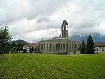
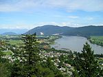
Pekw'Xe:yles or Peckquaylis is an Indian reserve on the north bank of the Fraser River in Mission, British Columbia, Canada, located between Lower Hatzic Slough and D'Herbomez Creek. It sits on the former site of St. Mary's Indian Residential School. 10.3 ha. in area, it was reinstated in June, 2005 by Order in Council and is used by 21 Indian bands.

Excerpt from the Wikipedia article Pekw'Xe:yles (License: CC BY-SA 3.0, Authors).

Pekw'Xe:yles
Lougheed Highway,

Geographical coordinates (GPS) Address Nearby Places
placeShow on map

Wikipedia: Pekw'Xe:ylesContinue reading on Wikipedia

Geographical coordinates (GPS)

Latitude Longitude
N 49.141388888889 ° E -122.27222222222 °
placeShow on map

Address

Lougheed Highway

Lougheed Highway
V2V 6Y9 , Hatzic
British Columbia, Canada
mapOpen on Google Maps

Share experience

Nearby Places

Hatzic
Hatzic

Hatzic is a historic community in the Central Fraser Valley region of the Lower Mainland of British Columbia, Canada, located on the east side of the City of Mission and including areas beyond the municipal boundary to the east and northeast. Hatzic is the location of two very important historical sites in British Columbia, the mission school of the Oblate Fathers (OMI), St. Mary's Indian Residential School, the name sake of the City of Mission, and Xá:ytem, an archaeological site and museum dating back over 9,000 years. Xá:ytem is a National Heritage Site of Canada. Also notable is Ferncliff Gardens, a private floral operation now becoming a heritage site. Hatzic Slough, which is part of the drainage for the oxbow Hatzic Lake, is the site of one of the world's largest dry-sorting yards for raw timber. A former railway station named Hatzic was located between the outlet of Hatzic Lake and the foot of the rise to the benchland where most of residential Hatzic is today.Mission's Fraser River Heritage Park is to the west and incorporates lands formerly belonging to the Oblate mission, including the foundations of the original school, though it is accessed from Mission proper, not via Hatzic. Hatzic is one of Mission's older suburban neighbourhoods and is home to Hatzic Secondary School and various elementary schools. Overlooking it from above is Westminster Abbey, a Benedictine monastery established in the 1950s, which is part of the Ferndale neighbourhood of Mission. Across the floodplain from the benchland Hatzic proper overlooks and where Hatzic Valley is located is the community of Dewdney, standing astride the bridge where British Columbia Highway 7 leads onto Nicomen Island. Across the Fraser River from Hatzic is the northeast sector of Matsqui Prairie.