Mount Utatsu
Ishikawa geography stubsMountains of Ishikawa Prefecture

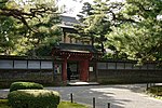
Mount Utatsu (卯辰山, Utatsu-yama) is a mountain in Kanazawa, Ishikawa Prefecture, Japan. It is also known by a number of other names, including Mount Mukai (向山, Mukai-yama), Mount Mukō (夢香山, Mukō-yama), Mount Garyū (臥竜山, Garyū-zan), and Mount Kasuga (春日山, Kasuga-yama). It is visible to the east of Kanazawa Castle and has Toyokuni Shrine located on its slopes. The summit of Mount Utatsu is used as a secondary triangulation point (named "Kanazawa") by the Geographical Survey Institute of Japan.
Excerpt from the Wikipedia article Mount Utatsu (License: CC BY-SA 3.0, Authors, Images).Mount Utatsu
Kanazawa
Geographical coordinates (GPS) Address Nearby Places Show on map
 Continue reading on Wikipedia
 Geographical coordinates (GPS)
| Latitude | Longitude |
|---|---|
| N 36.5732 ° | E 136.6778 ° |
Address
920-0926 Kanazawa
Japan
Open on Google Maps