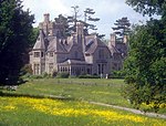
Corse, Gloucestershire
Forest of DeanUse British English from March 2015Villages in Gloucestershire

Corse is a village in the English county of Gloucestershire, next to the village of Staunton. The parish lies on the tongue of land between the River Severn and the River Leadon. It is 6 miles north of Gloucester and 7 miles south-west of Tewkesbury.St Margarets Church is mainly 14th century. Corse Court is mediaeval. The settlement of Snig's End, in the north of the parish was the site of a settlement for industrial workers under the auspices of the National Land Company in 1847.
Excerpt from the Wikipedia article Corse, Gloucestershire (License: CC BY-SA 3.0, Authors, Images).Corse, Gloucestershire
Church Lane, Forest of Dean Corse
Geographical coordinates (GPS) Address Nearby Places Show on map
Geographical coordinates (GPS)
| Latitude | Longitude |
|---|---|
| N 51.9359 ° | E -2.3087 ° |
Address
Church Lane
GL19 3BY Forest of Dean, Corse
England, United Kingdom
Open on Google Maps


