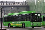
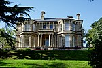
Victoria, Newport
Victoria is both a community (civil parish) and an electoral ward (division) of the city of Newport. The ward is bounded by the River Usk to the west and south, Newport Bridge, Clarence Place, Church Road and Christchurch Road to the north, Victoria Avenue, Wharf Road (as far as the railway bridge), a section of the Great Western Main Line as far as (but not including) Soho Street, Telford Street and Lilleshall Street to the east. The area is governed by the Newport City Council. The ward includes the district of Maindee, as well as the home of Newport Rugby Club and the annual Maindee Festival. The district of Victoria, Maindee in particular, is home to a large Asian population. Many people are of Pakistani and Bangladeshi origin and there are now a slowly increasing number of Kurdish refugees.
Excerpt from the Wikipedia article Victoria, Newport (License: CC BY-SA 3.0, Authors).Victoria, Newport
Victoria Avenue, Newport Victoria
Geographical coordinates (GPS) Address Nearby Places Show on map
Geographical coordinates (GPS)
| Latitude | Longitude |
|---|---|
| N 51.59129 ° | E -2.97577 ° |
Address
Victoria Avenue
Victoria Avenue
NP19 8EG Newport, Victoria
Wales, United Kingdom
Open on Google Maps


