Saw Mill Run

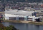
Saw Mill Run is a tributary of the Ohio River in Pennsylvania. It is an urban stream, and lies entirely within Allegheny County, Pennsylvania. The stream enters the Ohio just downstream from the Forks of the Ohio in Pittsburgh, at a place that was founded as the town of Temperanceville in the 1830s. It provides an entry through the elevated plateau south of Pittsburgh known as the South Hills, and land transportation has paralleled the stream since the nineteenth century. The stream is named for an actual saw mill that operated near the mouth of the stream where it empties into the Ohio River. The first reference to the mill is in relation to the construction of Fort Pitt (1759–1761). The mill provided much of the lumber used in the construction of the new Fort, after the British claimed the area from the French and destroyed Fort Duquesne.
Excerpt from the Wikipedia article Saw Mill Run (License: CC BY-SA 3.0, Authors, Images).Saw Mill Run
Ohio River Boulevard, Pittsburgh
Geographical coordinates (GPS) Address Nearby Places Show on map
Geographical coordinates (GPS)
| Latitude | Longitude |
|---|---|
| N 40.444722222222 ° | E -80.0275 ° |
Address
West End Bridge
Ohio River Boulevard
15233 Pittsburgh
Pennsylvania, United States
Open on Google Maps


