Aspen/Pitkin County Airport
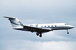
Aspen/Pitkin County Airport (IATA: ASE, ICAO: KASE, FAA LID: ASE), also known as Sardy Field, is a county-owned public-use airport located three nautical miles (6 km) northwest of the central business district of Aspen, in Pitkin County, Colorado, United States. Aspen/Pitkin Co. Airport/Sardy Field covers an area of 573 acres (232 ha) at an elevation of 7,820 feet (2,384 m) above mean sea level. It has one asphalt paved runway designated 15/33 which measures 8,006 by 100 feet (2,440 x 30 m).It is included in the Federal Aviation Administration (FAA) National Plan of Integrated Airport Systems for 2019–2023, in which it is categorized as a non-hub primary commercial service facility.
Excerpt from the Wikipedia article Aspen/Pitkin County Airport (License: CC BY-SA 3.0, Authors).Aspen/Pitkin County Airport
Owl Creek Road,
Geographical coordinates (GPS) Address External links Nearby Places Show on map
 Continue reading on Wikipedia
 Geographical coordinates (GPS)
| Latitude | Longitude |
|---|---|
| N 39.223055555556 ° | E -106.86888888889 ° |
Address
Aspen-Pitkin County Airport/Sardy Field (Aspen-Pitkin County Airport-Sardy Field)
Owl Creek Road
81615
Colorado, United States
Open on Google Maps