Atlantic, Seattle
Neighborhoods in Seattle

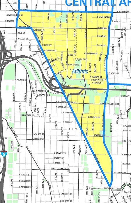
Atlantic is a neighborhood in the Central District of Seattle, Washington, United States. It is the northernmost neighborhood in the Rainier Valley area, located between Mount Baker Ridge and Beacon Hill, and may also be considered part of South Seattle. It is home to the Judkins Park neighborhood.
Excerpt from the Wikipedia article Atlantic, Seattle (License: CC BY-SA 3.0, Authors, Images).Atlantic, Seattle
South Lane Street, Seattle Central District
Geographical coordinates (GPS) Address Nearby Places Show on map
Geographical coordinates (GPS)
| Latitude | Longitude |
|---|---|
| N 47.596944444444 ° | E -122.30805555556 ° |
Address
South Lane Street 1818
98144 Seattle, Central District
Washington, United States
Open on Google Maps


