Cricket St Thomas
Civil parishes in SomersetCountry houses in SomersetStructures on the Heritage at Risk register in SomersetTourist attractions in SomersetUse British English from August 2012 ... and 2 more
Villages in South SomersetZoos in England

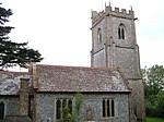
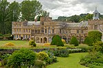
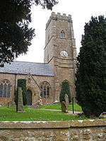
Cricket St Thomas is a parish in Somerset, England, situated in a valley between Chard and Crewkerne within the South Somerset administrative district. The A30 road passes nearby. The parish has a population of 50. It is noted for the historic manor house known as Cricket House, and its estate in recent times formerly home to a wildlife park.
Excerpt from the Wikipedia article Cricket St Thomas (License: CC BY-SA 3.0, Authors, Images).Cricket St Thomas
Swan Down,
Geographical coordinates (GPS) Address Nearby Places Show on map
Geographical coordinates (GPS)
| Latitude | Longitude |
|---|---|
| N 50.872 ° | E -2.895 ° |
Address
Hamilton's Tea Rooms
Swan Down
TA20 4DG , Cricket St. Thomas
England, United Kingdom
Open on Google Maps


