Winsham

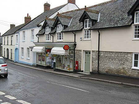
Winsham is a village and civil parish 4 miles (6 km) south-east of Chard and 6 miles (10 km) from Crewkerne, in the South Somerset district of Somerset, England. The parish, which has a population of approximately 750 residents living in some 335 households, includes the hamlets of Whatley, Bridge, Purtington and Ammerham, and covers an area of approximately 12 square miles (3,100 ha).The village is on the southern border of Somerset, approximately 0.4 miles (0.64 km) from the Dorset border, which is marked by the River Axe. Administratively it is in Area West, South Somerset District Council, and has a Parish Council elected by residents. Winsham Parish Council was one of the first to be formed in 1894, shortly after the passing of the Local Government Act of the same year.
Excerpt from the Wikipedia article Winsham (License: CC BY-SA 3.0, Authors, Images).Winsham
Fore Street,
Geographical coordinates (GPS) Address Nearby Places Show on map
Geographical coordinates (GPS)
| Latitude | Longitude |
|---|---|
| N 50.85356 ° | E -2.889928 ° |
Address
Winsham Information Exchange
Fore Street
TA20 4DX , Winsham
England, United Kingdom
Open on Google Maps


