place

Compton Dundon

Civil parishes in SomersetHill forts in SomersetUse British English from August 2012Villages in South Somerset
View towards Compton Dundon geograph.org.uk 892230

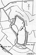
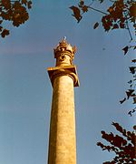
Compton Dundon is a village and civil parish in Somerset, England, lying beside King's Sedgemoor and the Polden Hills, 5 miles (8 km) south of Glastonbury and 4 miles (6 km) north of Somerton in the South Somerset district. The village has a population of 705. The parish includes the small village of Dundon and the hamlet of Littleton.

Excerpt from the Wikipedia article Compton Dundon (License: CC BY-SA 3.0, Authors, Images).

Compton Dundon
Ham Lane,

Geographical coordinates (GPS) Address Nearby Places
placeShow on map

Wikipedia: Compton DundonContinue reading on Wikipedia

Geographical coordinates (GPS)

Latitude Longitude
N 51.0918 ° E -2.7323 °
placeShow on map

Address

Ham Lane

Ham Lane
TA11 6PQ , Compton Dundon
England, United Kingdom
mapOpen on Google Maps

View towards Compton Dundon geograph.org.uk 892230
Share experience

Nearby Places

Street, Somerset
Street, Somerset

Street is a large village and civil parish in Somerset, England, with a population of 11,805 in 2011. On a dry spot in the Somerset Levels, at the end of the Polden Hills, it is two miles (three kilometres) southwest of Glastonbury. There is evidence of Roman occupation. Much of the history of the village is dominated by Glastonbury Abbey, and a 12th-century causeway from Glastonbury built to transport local Blue Lias stone to it. The Society of Friends was established there by the mid-17th century. One Quaker family, the Clarks, started a business in sheepskin rugs, woollen slippers and, later, boots and shoes. This became C&J Clark which still has its headquarters in Street. In 1993, redundant factory buildings were converted to form Clarks Village, the first purpose-built factory outlet in the United Kingdom. The Shoe Museum provides information about the history of Clarks and footwear manufacture in general. The Clark family's former mansion and its estate at the edge of the village are now owned by Millfield School, an independent co-educational boarding school. Street is also home to Crispin School and Strode College. To the north of Street is the River Brue, which marks the boundary with Glastonbury. South of Street are the Walton and Ivythorn Hills and East Polden Grasslands biological Sites of Special Scientific Interest. Strode Theatre provides a venue for films, exhibitions and live performances. The Anglican Parish Church of The Holy Trinity dates from the 14th century and has been designated by English Heritage as a Grade I listed building.